Area Overview for Inverurie
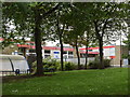
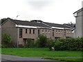
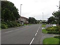
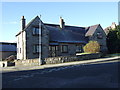
Photos of Inverurie
Area Information
Inverurie is a prosperous town located in Aberdeenshire, north-east Scotland. It sits on the north bank of the River Don, opposite Port Elphinstone, at the confluence of two waterways. This built-up area covers 5.3 square kilometres. The town lies sixteen miles northwest of Aberdeen. The name derives from the Scottish Gaelic *Inbhir Uraidh*, meaning the mouth of the Ury River. Residents enjoy a setting shaped by over a thousand years of history. David of Huntingdon established the area as an administrative centre in the late 12th century. The town received a royal charter from Queen Mary in 1558. This charter authorised two weekly markets and two yearly fairs. A monastery had been established nearby by around 1000, predating the secular foundation of the town. St Andrew's Parish Church represents this ancient religious heritage. The Great North of Scotland Railway reached Inverurie in 1854, connecting it to Aberdeen and Inverness. The Oil Boom of the last quarter of the 20th century drove significant modern expansion. You will find The Bass at the south-east corner of the town. This site holds an 11th-century motte and bailey castle built by the Earl of Garioch. The area offers a mix of historical significance and modern prosperity for anyone living in Inverurie.
- Area Type
- Built Up Area 250
- Area Size
- 5.3 km²
- Population
- Not available
- Population Density
- Not available
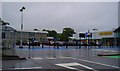
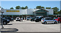
Living in Inverurie provides direct access to specific retail, rail, and leisure amenities. Within practical reach of residents, you will find Aldi Inverurie, Farmfoods Inverurie, and Tesco Inverurie. These three notable retailers satisfy daily shopping needs for groceries and household essentials. The town boasts a built-up area of 5.3 square kilometres, concentrating these services effectively. Beyond shopping, you have access to two notable railway stations. Inverurie Railway Station offers direct connections, while Kintore Railway Station serves as an additional transport hub close by. The town's character is deeply rooted in its history. The Bass, located at the south-east corner, is the site of an 11th-century motte and bailey castle. St Andrew's Parish Church represents the town's ancient religious foundation. A River Don bridge dating from 1797 crosses the water. The Battle of Harlaw memorial marks the site of the 1411 battle two miles north of Inverurie. These landmarks are integrated into the daily life of residents. You can enjoy views of the River Don and the Urie while shopping at the local supermarkets. The proximity of transport links ensures easy access for business or leisure travel.
Amenities
Schools
| Rank | School | Type | Entry gender | Ages |
|---|
Explore more schools in this area
Go to Schools tabDemographics
Data regarding the specific demographics of Inverurie is currently unavailable. There are no figures provided for the age profile of the population or the breakdown of household types. Information on home ownership levels, accommodation types, and population diversity is not included in the available sources. Consequently, it is impossible to state what percentage of residents own their homes or what proportion of the community consists of families versus single-person households. Without specific data on deprivation metrics, one cannot explain what this might mean for quality of life in this part of Aberdeenshire. The absence of statistical details prevents a precise description of who lives here beyond the historical and geographical context of the town. Prospective buyers seeking demographic insights must rely on external sources, as the local data records do not currently publish these specific figures for Inverurie.
Household Size
Accommodation Type
Tenure
Ethnic Group
Religion
Household Composition
Age
Household Deprivation
NS-SEC
Explore more demographic insights in this area
Go to Demographics tabPlanning
Planning Constraints
- Crime RiskPremium