Area Overview for Aboyne, Upper Deeside and Donside Ward
Photos of Aboyne, Upper Deeside and Donside Ward


Area Information
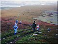
Living in Aboyne, Upper Deeside and Donside Ward offers a distinctly rural lifestyle within Aberdeenshire Council in Scotland. This electoral ward, known locally as Ward 15, spans a vast 1748.5 km² and serves as a hub for the upper Deeside and Donside regions. You will find the population spread thinly across this landscape, with a total of 11,133 residents recorded in 2022. The ward is dominated by Aboyne village, which acts as a vital service centre for the surrounding countryside. Its character is defined by a blend of Highland charm, strong community spirit, and access to outdoor adventures. Aboyne functions as a suburban commuter locality for some, while providing essential amenities for local inhabitants. The area centre features a historic town site protected as a Conservation Area, centring on Charleelston Green and overlooking the River Dee. This setting creates a quiet environment where daily life moves at a slower pace. You are looking at a location that values heritage and nature over urban density. The ward elects three councillors to represent it, ensuring local governance remains connected to the communities it serves.
- Area Type
- District Borough Unitary Ward
- Area Size
- 1748.5 km²
- Population
- Not available
- Population Density
- Not available
Demographics
The community in Aboyne, Upper Deeside and Donside Ward is sparse and largely rural, reflecting the wider Highland landscape. The density reaches just 0.05 dwellings per hectare, meaning you will find large distances between neighbours. This low density shapes the local character, fostering a close-knit atmosphere where residents often know one another well. The economy supports this population through sectors including education, health, retail, and professional services. Retail activity has grown by 33% since 2020, suggesting increasing commercial vitality within the ward. In 2023, the median household income stood at £49,456, a figure that sits above the Aberdeenshire average. This economic strength supports a stable environment for families and individuals seeking financial security. While specific age profiles or household type breakdowns are not included in the available records, the economic data points to a relatively affluent demographic. You can expect a community that values stability and has the financial means to access local services. The population size of 11,133 indicates a small-scale society where local businesses and amenities are crucial for daily living.
Household Size
Accommodation Type
Tenure
Ethnic Group
Religion
Household Composition
Age
Household Deprivation
NS-SEC
Explore more demographic insights in this area
Go to Demographics tabPlanning
Planning Constraints
- Flood RiskPremium
- Ramsar Wetland SitesPremium
- Area of Outstanding Natural BeautyPremium
- Protected Nature ReservePremium
- Protected WoodlandPremium
- Crime RiskPremium