Area Overview for AB54 4SR
Photos of AB54 4SR
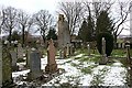
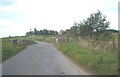
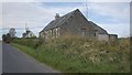

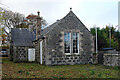
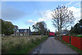
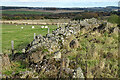
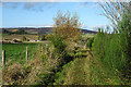
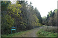
20 photos from this area
Area Information
Key information about the AB54 4SR including its size, population, and administrative classification.
- Area Type
- Postcode
- Area Size
- 1.6 km²
- Population
- Not available
- Population Density
- Not available
House Prices in AB54 4SR
15
Properties
-
Average Sold Price
-
Lowest Price
-
Highest Price
Showing 15 properties
| Address | Type | Beds | Baths | Last Sale Price | Last Sale Date | |
|---|---|---|---|---|---|---|
| Old Post Office, Church Road, Ruthven, Huntly, AB54 4SR | Bungalow | 1 | 1 | - | - | |
| Millsyde, Church Road, Ruthven, Huntly, AB54 4SR | Bungalow | 3 | 1 | - | - | |
| Mill Park, Church Road, Ruthven, Huntly, AB54 4SR | Detached | 3 | 1 | - | - | |
| Caravan Borve House, Church Road, Ruthven, Huntly, AB54 4SR | Detached | 1 | 1 | - | - | |
| Mill House, C 106 S U 108 S At Garromuir Wood Via Ruthven To Dykehead Access Road, Ruthven, Huntly, AB54 4SR | Detached | 3 | - | - | - | |
| Ivy Cottage, Church Road, Ruthven, Huntly, AB54 4SR | Land | - | - | - | - | |
| Churchyard, Church Road, Ruthven, Huntly, AB54 4SR | commercial | - | - | - | - | |
| Rowin Stane, Church Road, Ruthven, Huntly, AB54 4SR | Detached | - | - | - | - | |
| Borve Brewery, Borve House, Church Road, Ruthven, Huntly, AB54 4SR | Bungalow | - | - | - | - | |
| Stonehouse, Church Road, Ruthven, Huntly, AB54 4SR | Detached | - | - | - | - |
Page 1 of 2
Energy Efficiency in AB54 4SR
Amenities
Schools
| Rank | School | Type | Entry gender | Ages |
|---|
Explore more schools in this area
Go to Schools tabDemographics
Household Size
N/A
most common
Accommodation Type
N/A
most common
Tenure
N/A
majority
Ethnic Group
N/A
most common
Religion
N/A
most common
Household Composition
N/A
most common
Age
N/A
median
N/A
most common
Household Deprivation
N/A
with no deprivation
NS-SEC
N/A
in Lower managerial occupations
Explore more demographic insights in this area
Go to Demographics tabPlanning
Planning Constraints
- Flood RiskPremium
- Ramsar Wetland SitesPremium
- Area of Outstanding Natural BeautyPremium
- Protected Nature ReservePremium
- Protected WoodlandPremium
- Crime RiskPremium