Area Overview for AB52 6XF
Photos of AB52 6XF
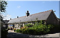
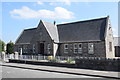
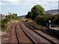
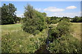
10 photos from this area
Area Information
Key information about the AB52 6XF including its size, population, and administrative classification.
- Area Type
- Postcode
- Area Size
- 1.8 hectares
- Population
- Not available
- Population Density
- Not available
House Prices in AB52 6XF
14
Properties
-
Average Sold Price
-
Lowest Price
-
Highest Price
Showing 14 properties
| Address | Type | Beds | Baths | Last Sale Price | Last Sale Date | |
|---|---|---|---|---|---|---|
| Damior, South Road, Insch, AB52 6XF | Detached | - | - | - | - | |
| Inchriach, South Road, Insch, AB52 6XF | Semi-detached | - | - | - | - | |
| Genesis House, South Road, Insch, AB52 6XF | house | - | - | - | - | |
| Barrem Motors Ltd, Barrem Motors Workshop, South Road, Insch, AB52 6XF | Industrial | - | - | - | - | |
| Grc Aqua Tech, Yard, G R C Aqua Tech, South Road, Insch, AB52 6XF | warehouse | - | - | - | - | |
| George Moir, Insch Industrial Estate, South Road, Insch, AB52 6XF | shop | - | - | - | - | |
| J D Motor Engineers, Unit 2, Insch Industrial Estate, South Road, Insch, AB52 6XF | shop | - | - | - | - | |
| Specialist Rov Tooling Services Ltd, Unit 1, Insch Industrial Estate, South Road, Insch, AB52 6XF | shop | - | - | - | - | |
| H R N Tractors Ltd, South Road, Insch, AB52 6XF | Industrial | - | - | - | - | |
| Grc Aqua Tech, G R C Aqua Tech, South Road, Insch, AB52 6XF | Industrial | - | - | - | - |
Page 1 of 2
Energy Efficiency in AB52 6XF
Amenities
Schools
| Rank | School | Type | Entry gender | Ages |
|---|
Explore more schools in this area
Go to Schools tabDemographics
Household Size
N/A
most common
Accommodation Type
N/A
most common
Tenure
N/A
majority
Ethnic Group
N/A
most common
Religion
N/A
most common
Household Composition
N/A
most common
Age
N/A
median
N/A
most common
Household Deprivation
N/A
with no deprivation
NS-SEC
N/A
in Lower managerial occupations
Explore more demographic insights in this area
Go to Demographics tabPlanning
Planning Constraints
- Flood RiskPremium
- Ramsar Wetland SitesPremium
- Area of Outstanding Natural BeautyPremium
- Protected Nature ReservePremium
- Protected WoodlandPremium
- Crime RiskPremium