Area Overview for PL10 1LL
Photos of PL10 1LL
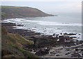
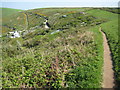
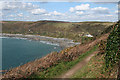

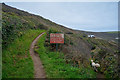
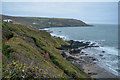
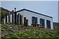
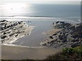
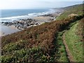

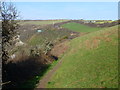
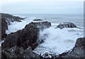
22 photos from this area
Area Information
Key information about the PL10 1LL including its size, population, and administrative classification.
- Area Type
- Postcode
- Area Size
- 54.6 hectares
- Population
- Not available
- Population Density
- Not available
House Prices in PL10 1LL
6
Properties
£240,750
Average Sold Price
£96,500
Lowest Price
£385,000
Highest Price
Showing 6 properties
| Address | Type | Beds | Baths | Last Sale Price | Last Sale Date | |
|---|---|---|---|---|---|---|
| Polhawn Cottage, Access To Polhawn, Polhawn, Torpoint, PL10 1LL | house | 5 | - | £385,000 | Mar 2004 | |
| Monk Rock Cottage, Access To Polhawn, Polhawn, Torpoint, PL10 1LL | house | - | - | £96,500 | Sep 1996 | |
| Former Brownleaves Chalet, Access To Polhawn, Polhawn, Torpoint, PL10 1LL | Detached | - | - | - | - | |
| The Annexe At, Polhawn Cottage, Access To Polhawn, Polhawn, Torpoint, PL10 1LL | Semi-detached | - | - | - | - | |
| Polhawn Fort, Access To Polhawn, Polhawn, Torpoint, PL10 1LL | commercial | - | - | - | - | |
| Windrush, Access To Polhawn, Polhawn, Torpoint, PL10 1LL | house | - | - | - | - |
Energy Efficiency in PL10 1LL
Amenities
Schools
| Rank | School | Type | Entry gender | Ages |
|---|
Explore more schools in this area
Go to Schools tabDemographics
Household Size
total
most common
Accommodation Type
total
most common
Tenure
71
majority
Ethnic Group
total
most common
Religion
total
most common
Household Composition
total
most common
Age
70
median
Age: Total
most common
Household Deprivation
N/A
with no deprivation
NS-SEC
39
in Lower managerial occupations
Explore more demographic insights in this area
Go to Demographics tabPlanning
Planning Constraints
- Flood RiskPremium
- Ramsar Wetland SitesPremium
- Area of Outstanding Natural BeautyPremium
- Protected Nature ReservePremium
- Protected WoodlandPremium