Area Overview for NE67 5BH
Photos of NE67 5BH
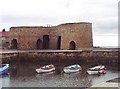

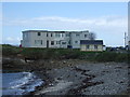

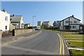

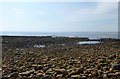
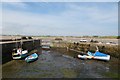
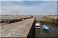

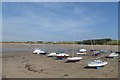
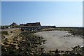
100 photos from this area
Area Information
Key information about the NE67 5BH including its size, population, and administrative classification.
- Area Type
- Postcode
- Area Size
- 7.6 hectares
- Population
- Not available
- Population Density
- Not available
House Prices in NE67 5BH
20
Properties
£433,133
Average Sold Price
£330,000
Lowest Price
£519,400
Highest Price
Showing 20 properties
| Address | Type | Beds | Baths | Last Sale Price | Last Sale Date | |
|---|---|---|---|---|---|---|
| 120 Harbour Road, Beadnell, NE67 5BH | house | - | - | £519,400 | Aug 2020 | |
| 108 Harbour Road, Beadnell, NE67 5BH | Detached | - | - | £330,000 | Feb 2019 | |
| 116 Harbour Road, Beadnell, NE67 5BH | Bungalow | 3 | - | £450,000 | Oct 2010 | |
| 11 Harbour Road, Beadnell, NE67 5BH | Detached | 3 | - | - | - | |
| 124 Harbour Road, Beadnell, NE67 5BH | Bungalow | 2 | - | - | - | |
| Shorestone, 118 Harbour Road, Beadnell, NE67 5BH | hotel | - | - | - | - | |
| Torwoodlee, 118 Harbour Road, Beadnell, NE67 5BH | hotel | - | - | - | - | |
| 15 Harbour Road, Beadnell, NE67 5BH | Semi-detached | - | - | - | - | |
| 21 Harbour Road, Beadnell, NE67 5BH | Detached | - | - | - | - | |
| Flat 3, White Rock, Harbour Road, Beadnell, NE67 5BH | Flat | - | - | - | - |
Page 1 of 2
Energy Efficiency in NE67 5BH
Amenities
Schools
| Rank | School | Type | Entry gender | Ages |
|---|
Explore more schools in this area
Go to Schools tabDemographics
Household Size
total
most common
Accommodation Type
total
most common
Tenure
68
majority
Ethnic Group
total
most common
Religion
total
most common
Household Composition
total
most common
Age
70
median
Age: Total
most common
Household Deprivation
N/A
with no deprivation
NS-SEC
32
in Lower managerial occupations
Explore more demographic insights in this area
Go to Demographics tabPlanning
Planning Constraints
- Flood RiskPremium
- Ramsar Wetland SitesPremium
- Area of Outstanding Natural BeautyPremium
- Protected Nature ReservePremium
- Protected WoodlandPremium