Area Overview for YO8 8JF
Photos of YO8 8JF
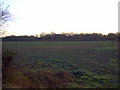
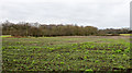

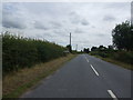
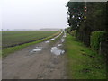
9 photos from this area
Area Information
Key information about the YO8 8JF including its size, population, and administrative classification.
- Area Type
- Postcode
- Area Size
- 1.9 km²
- Population
- 1759
- Population Density
- 149 people/km²
House Prices in YO8 8JF
22
Properties
£349,250
Average Sold Price
£185,000
Lowest Price
£505,000
Highest Price
Showing 22 properties
| Address | Type | Beds | Baths | Last Sale Price | Last Sale Date | |
|---|---|---|---|---|---|---|
| Mistra, Barlow Common Road, Barlow, YO8 8JF | Bungalow | - | - | £350,000 | Mar 2024 | |
| Oakleigh, Barlow Common Road, Barlow, YO8 8JF | Bungalow | 3 | 1 | £505,000 | Jan 2023 | |
| Bracken House, Barlow Common Road, Barlow, YO8 8JF | Detached | 4 | 1 | £357,000 | Oct 2017 | |
| 1, Botany Bay Cottages, Barlow Common Road, Barlow, YO8 8JF | Semi-detached | - | - | £185,000 | Dec 2005 | |
| Stanley Cottage, Barlow Common Road, Barlow, YO8 8JF | Detached | 6 | - | - | - | |
| Caravan, Stanley Cottage, Barlow Common Road, Barlow, YO8 8JF | Mobile Home | - | - | - | - | |
| Applegarth, Barlow Common Road, Barlow, YO8 8JF | house | - | - | - | - | |
| Woodmans House, Barlow Common Road, Barlow, YO8 8JF | Detached | - | - | - | - | |
| Caravan At, Commonside Farm, Barlow Common Road, Barlow, YO8 8JF | Mobile Home | - | - | - | - | |
| Arosa, Barlow Common Road, Barlow, YO8 8JF | Semi-detached | - | - | - | - |
Page 1 of 3
Energy Efficiency in YO8 8JF
Amenities
Schools
| Rank | School | Type | Entry gender | Ages |
|---|
Explore more schools in this area
Go to Schools tabDemographics
Household Size
Two person
most common
Accommodation Type
Houses
most common
Tenure
91
majority
Ethnic Group
White
most common
Religion
N/A
most common
Household Composition
N/A
most common
Age
47
median
Adults (30-64 years)
most common
Household Deprivation
N/A
with no deprivation
NS-SEC
36
in Lower managerial occupations
Explore more demographic insights in this area
Go to Demographics tabPlanning
Planning Constraints
- Flood RiskPremium
- Ramsar Wetland SitesPremium
- Area of Outstanding Natural BeautyPremium
- Protected Nature ReservePremium
- Protected WoodlandPremium