Area Overview for YO8 3ND
Photos of YO8 3ND
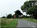

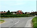
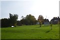
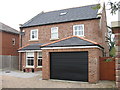
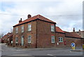
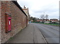
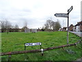
30 photos from this area
Area Information
Key information about the YO8 3ND including its size, population, and administrative classification.
- Area Type
- Postcode
- Area Size
- 8.4 hectares
- Population
- 1392
- Population Density
- 1363 people/km²
House Prices in YO8 3ND
50
Properties
£168,998
Average Sold Price
£50,500
Lowest Price
£315,000
Highest Price
Showing 50 properties
| Address | Type | Beds | Baths | Last Sale Price | Last Sale Date | |
|---|---|---|---|---|---|---|
| 27 Hill Field, Selby, YO8 3ND | Semi-detached | 2 | 1 | £215,000 | Dec 2024 | |
| 5 Hill Field, Selby, YO8 3ND | Semi-detached | 3 | 1 | £207,000 | Dec 2023 | |
| 37 Hill Field, Selby, YO8 3ND | Semi-detached | 3 | 1 | £187,500 | May 2023 | |
| 17 Hill Field, Selby, YO8 3ND | Semi-detached | 3 | 1 | £216,000 | Feb 2023 | |
| 14 Hill Field, Selby, YO8 3ND | house | - | - | £240,000 | Feb 2022 | |
| 16 Hill Field, Selby, YO8 3ND | Detached | 3 | 1 | £239,500 | Sep 2021 | |
| 4 Hill Field, Selby, YO8 3ND | Bungalow | - | - | £247,000 | Feb 2021 | |
| 43 Hill Field, Selby, YO8 3ND | Bungalow | 3 | 1 | £205,000 | Dec 2019 | |
| 59 Hill Field, Selby, YO8 3ND | Detached | 3 | 1 | £195,000 | Oct 2019 | |
| 45 Hill Field, Selby, YO8 3ND | Semi-detached | 2 | 1 | £140,000 | Apr 2019 |
Page 1 of 5
Energy Efficiency in YO8 3ND
Amenities
Schools
| Rank | School | Type | Entry gender | Ages |
|---|
Explore more schools in this area
Go to Schools tabDemographics
Household Size
Two person
most common
Accommodation Type
Houses
most common
Tenure
74
majority
Ethnic Group
White
most common
Religion
N/A
most common
Household Composition
N/A
most common
Age
47
median
Adults (30-64 years)
most common
Household Deprivation
N/A
with no deprivation
NS-SEC
30
in Lower managerial occupations
Explore more demographic insights in this area
Go to Demographics tabPlanning
Planning Constraints
- Flood RiskPremium
- Ramsar Wetland SitesPremium
- Area of Outstanding Natural BeautyPremium
- Protected Nature ReservePremium
- Protected WoodlandPremium