Area Overview for YO7 3AA
Photos of YO7 3AA


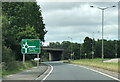

14 photos from this area
Area Information
Key information about the YO7 3AA including its size, population, and administrative classification.
- Area Type
- Postcode
- Area Size
- 62.3 hectares
- Population
- 1964
- Population Density
- 27 people/km²
House Prices in YO7 3AA
13
Properties
£326,667
Average Sold Price
£100,000
Lowest Price
£505,000
Highest Price
Showing 13 properties
| Address | Type | Beds | Baths | Last Sale Price | Last Sale Date | |
|---|---|---|---|---|---|---|
| Oakfield, York Road, Thirsk, YO7 3AA | Detached | 3 | 1 | £375,000 | Aug 2021 | |
| Brynklehowe, York Road, Thirsk, YO7 3AA | Detached | 5 | 3 | £505,000 | Mar 2017 | |
| South Villa, York Road, Thirsk, YO7 3AA | house | - | - | £100,000 | Nov 2006 | |
| 4 York Road, Thirsk, YO7 3AA | Detached | 3 | - | - | - | |
| 2, South Villa, York Road, Thirsk, YO7 3AA | Semi-detached | - | - | - | - | |
| 1, South Villa, York Road, Thirsk, YO7 3AA | Semi-detached | - | - | - | - | |
| Earley Ornamentals Limited, Holme Lea Nursery Bungalow, York Road, Thirsk, YO7 3AA | Office | - | - | - | - | |
| Banner Tension Solutions, Part Of, Langver Engineering, Thirsk Industrial Park, Thirsk, YO7 3AA | Industrial | - | - | - | - | |
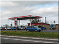
| Mcdonald's, Unit 1, Thirsk Services, York Road, Thirsk, YO7 3AA | storage_distribution | - | - | - | - | |
| Costa Coffee, Unit 2, Thirsk Services, York Road, Thirsk, YO7 3AA | restaurant_cafe | - | - | - | - |
Page 1 of 2
Energy Efficiency in YO7 3AA
Amenities
Schools
| Rank | School | Type | Entry gender | Ages |
|---|
Explore more schools in this area
Go to Schools tabDemographics
Household Size
Two person
most common
Accommodation Type
Houses
most common
Tenure
75
majority
Ethnic Group
White
most common
Religion
N/A
most common
Household Composition
N/A
most common
Age
47
median
Adults (30-64 years)
most common
Household Deprivation
N/A
with no deprivation
NS-SEC
40
in Lower managerial occupations
Explore more demographic insights in this area
Go to Demographics tabPlanning
Planning Constraints
- Flood RiskPremium
- Ramsar Wetland SitesPremium
- Area of Outstanding Natural BeautyPremium
- Protected Nature ReservePremium
- Protected WoodlandPremium