Area Overview for YO7 2HL
Photos of YO7 2HL
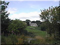


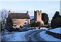
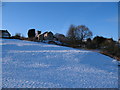
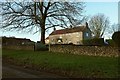
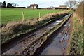
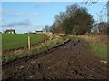
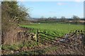
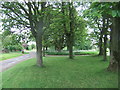
45 photos from this area
Area Information
Key information about the YO7 2HL including its size, population, and administrative classification.
- Area Type
- Postcode
- Area Size
- 3.3 km²
- Population
- 2144
- Population Density
- 10 people/km²
House Prices in YO7 2HL
41
Properties
£410,783
Average Sold Price
£227,500
Lowest Price
£710,000
Highest Price
Showing 41 properties
| Address | Type | Beds | Baths | Last Sale Price | Last Sale Date | |
|---|---|---|---|---|---|---|
| Angram Grange, Main Street, Cold Kirby, YO7 2HL | Retail | 6 | 2 | £637,500 | Sep 2025 | |
| Oak Dale, Main Street, Cold Kirby, YO7 2HL | house | - | - | £570,000 | Sep 2024 | |
| Kirby House, Main Street, Cold Kirby, YO7 2HL | Detached | - | - | £590,000 | May 2024 | |
| Ailred Barn, Main Street, Cold Kirby, YO7 2HL | Bungalow | - | - | £355,000 | Jun 2021 | |
| Oak House, Main Street, Cold Kirby, YO7 2HL | Detached | 5 | - | £710,000 | Jan 2021 | |
| Sheraton Cottage, Main Street, Cold Kirby, YO7 2HL | Detached | 3 | 2 | £320,000 | Mar 2018 | |
| Beulah House, Main Street, Cold Kirby, YO7 2HL | Detached | 4 | 1 | £335,000 | Feb 2018 | |
| Pentland House, Main Street, Cold Kirby, YO7 2HL | Detached | 3 | 1 | £445,000 | Dec 2015 | |
| Chapel House, Main Street, Cold Kirby, YO7 2HL | Cottage | 3 | 2 | £250,000 | Oct 2015 | |
| IVY HOUSE, LOW FIELD LANE, Cold Kirby, Helmsley, YO7 2HL | Detached | 4 | 3 | £235,000 | May 2014 |
Page 1 of 5
Energy Efficiency in YO7 2HL
Amenities
Schools
| Rank | School | Type | Entry gender | Ages |
|---|
Explore more schools in this area
Go to Schools tabDemographics
Household Size
Two person
most common
Accommodation Type
Houses
most common
Tenure
59
majority
Ethnic Group
White
most common
Religion
N/A
most common
Household Composition
N/A
most common
Age
47
median
Adults (30-64 years)
most common
Household Deprivation
N/A
with no deprivation
NS-SEC
34
in Lower managerial occupations
Explore more demographic insights in this area
Go to Demographics tabPlanning
Planning Constraints
- Flood RiskPremium
- Ramsar Wetland SitesPremium
- Area of Outstanding Natural BeautyPremium
- Protected Nature ReservePremium
- Protected WoodlandPremium