Area Overview for YO62 7RX
Photos of YO62 7RX
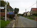

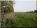
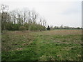

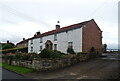
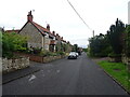
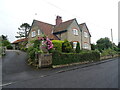
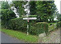
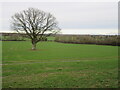
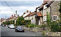
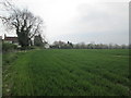
23 photos from this area
Area Information
Key information about the YO62 7RX including its size, population, and administrative classification.
- Area Type
- Postcode
- Area Size
- 19.0 hectares
- Population
- 1841
- Population Density
- 68 people/km²
House Prices in YO62 7RX
37
Properties
£337,653
Average Sold Price
£82,000
Lowest Price
£835,000
Highest Price
Showing 37 properties
| Address | Type | Beds | Baths | Last Sale Price | Last Sale Date | |
|---|---|---|---|---|---|---|
| Hillside, Main Street, Wombleton, YO62 7RX | house | - | - | £555,000 | Dec 2024 | |
| Penn Cottage, Main Street, Wombleton, YO62 7RX | house | 2 | - | £275,000 | Sep 2024 | |
| Lilac Cottage, Main Street, Wombleton, YO62 7RX | Semi-detached | 2 | 1 | £245,000 | Feb 2024 | |
| Indra House, Main Street, Wombleton, YO62 7RX | Detached | 3 | 2 | £580,356 | Nov 2023 | |
| High Croft, Main Street, Wombleton, YO62 7RX | Detached | 4 | 3 | £835,000 | Oct 2023 | |
| Prospect House, Main Street, Wombleton, YO62 7RX | Detached | 5 | - | £595,000 | Nov 2020 | |
| Minerva House, Main Street, Wombleton, YO62 7RX | house | 3 | - | £582,000 | Nov 2020 | |
| Dove Cottage, Main Street, Wombleton, YO62 7RX | Bungalow | 3 | 2 | £267,000 | Jan 2020 | |
| The Cedars, Main Street, Wombleton, YO62 7RX | house | - | - | £430,000 | Oct 2018 | |
| Mulberry Cottage, Main Street, Wombleton, YO62 7RX | house | - | - | £465,000 | Oct 2017 |
Page 1 of 4
Energy Efficiency in YO62 7RX
Amenities
Schools
| Rank | School | Type | Entry gender | Ages |
|---|
Explore more schools in this area
Go to Schools tabDemographics
Household Size
Two person
most common
Accommodation Type
Houses
most common
Tenure
73
majority
Ethnic Group
White
most common
Religion
N/A
most common
Household Composition
N/A
most common
Age
47
median
Adults (30-64 years)
most common
Household Deprivation
N/A
with no deprivation
NS-SEC
33
in Lower managerial occupations
Explore more demographic insights in this area
Go to Demographics tabPlanning
Planning Constraints
- Flood RiskPremium
- Ramsar Wetland SitesPremium
- Area of Outstanding Natural BeautyPremium
- Protected Nature ReservePremium
- Protected WoodlandPremium