Area Overview for YO62 6NN
Photos of YO62 6NN
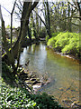
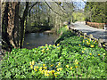
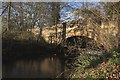
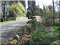
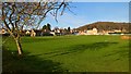
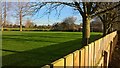
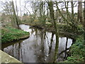
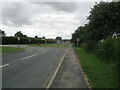
47 photos from this area
Area Information
Key information about the YO62 6NN including its size, population, and administrative classification.
- Area Type
- Postcode
- Area Size
- 2.9 hectares
- Population
- 1841
- Population Density
- 68 people/km²
House Prices in YO62 6NN
10
Properties
£203,990
Average Sold Price
£100,000
Lowest Price
£274,950
Highest Price
Showing 10 properties
| Address | Type | Beds | Baths | Last Sale Price | Last Sale Date | |
|---|---|---|---|---|---|---|
| 26 Kirby Mills Road, Kirkby Mills, YO62 6NN | house | 3 | 1 | £250,000 | Nov 2016 | |
| White Cottage, Village Street, Keldholme, YO62 6NN | Bungalow | - | - | £274,950 | Sep 2016 | |
| Glenrose, Village Street, Keldholme, YO62 6NN | Bungalow | - | - | £180,000 | Nov 2010 | |
| Heathercroft, Village Street, Keldholme, YO62 6NN | house | - | - | £215,000 | Jun 2008 | |
| Langsett, Village Street, Keldholme, YO62 6NN | Detached | 3 | 1 | £100,000 | Aug 1998 | |
| Meadow Court, Village Street, Keldholme, YO62 6NN | Detached | - | - | - | - | |
| Ely Cottage, 28 Kirby Mills Road, Kirkby Mills, YO62 6NN | Terraced | - | - | - | - | |
| Cruck Cottage, Kirby Mills Road, Kirkby Mills, YO62 6NN | Detached | - | - | - | - | |
| Ivy Cottage, 29 Kirby Mills Road, Kirkby Mills, YO62 6NN | Terraced | - | - | - | - | |
| Ammonite Cottage, 27 Kirby Mills Road, Kirkby Mills, YO62 6NN | house | - | - | - | - |
Energy Efficiency in YO62 6NN
Amenities
Schools
| Rank | School | Type | Entry gender | Ages |
|---|
Explore more schools in this area
Go to Schools tabDemographics
Household Size
Two person
most common
Accommodation Type
Houses
most common
Tenure
73
majority
Ethnic Group
White
most common
Religion
N/A
most common
Household Composition
N/A
most common
Age
47
median
Adults (30-64 years)
most common
Household Deprivation
N/A
with no deprivation
NS-SEC
33
in Lower managerial occupations
Explore more demographic insights in this area
Go to Demographics tabPlanning
Planning Constraints
- Flood RiskPremium
- Ramsar Wetland SitesPremium
- Area of Outstanding Natural BeautyPremium
- Protected Nature ReservePremium
- Protected WoodlandPremium