Area Overview for YO62 5LS
Photos of YO62 5LS
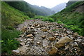
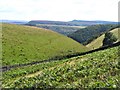
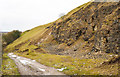
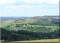
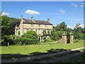
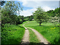
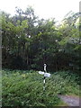
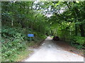
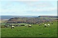
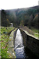
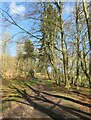
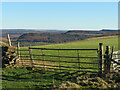
37 photos from this area
Area Information
Key information about the YO62 5LS including its size, population, and administrative classification.
- Area Type
- Postcode
- Area Size
- 15.1 km²
- Population
- 2144
- Population Density
- 10 people/km²
House Prices in YO62 5LS
19
Properties
-
Average Sold Price
-
Lowest Price
-
Highest Price
Showing 19 properties
| Address | Type | Beds | Baths | Last Sale Price | Last Sale Date | |
|---|---|---|---|---|---|---|
| Noddle End, Peak Scar Road, Hawnby, YO62 5LS | Detached | - | - | - | - | |
| 4, Arden Hall Cottages, Arden Hall Road, Hawnby, YO62 5LS | Terraced | - | - | - | - | |
| Cooks Cottage, Arden Hall, Arden Hall Road, Hawnby, YO62 5LS | Semi-detached | - | - | - | - | |
| Gamekeepers House, Arden Hall Road, Hawnby, YO62 5LS | Semi-detached | - | - | - | - | |
| Wood Vue Flat, Hawnby Lodge, Hawnby To Arden Hall, Hawnby, YO62 5LS | Flat | - | - | - | - | |
| The Game Flat, Hawnby Lodge, Hawnby To Arden Hall, Hawnby, YO62 5LS | Flat | - | - | - | - | |
| First Floor Flat Hawnby Lodge, Hawnby To Arden Hall, Hawnby, YO62 5LS | Maisonette | - | - | - | - | |
| Arden Bank Quarry, Arden Hall Road, Hawnby, YO62 5LS | Industrial | - | - | - | - | |
| Tennis 107M From Cooks Cottage, Arden Hall 29M From Unnamed Road, Hawnby To Arden Hall, Hawnby, YO62 5LS | Leisure | - | - | - | - | |
| Estate Office, Hawnby Lodge, Hawnby To Arden Hall, Hawnby, YO62 5LS | Office | - | - | - | - |
Page 1 of 2
Energy Efficiency in YO62 5LS
Amenities
Schools
| Rank | School | Type | Entry gender | Ages |
|---|
Explore more schools in this area
Go to Schools tabDemographics
Household Size
Two person
most common
Accommodation Type
Houses
most common
Tenure
59
majority
Ethnic Group
White
most common
Religion
N/A
most common
Household Composition
N/A
most common
Age
47
median
Adults (30-64 years)
most common
Household Deprivation
N/A
with no deprivation
NS-SEC
34
in Lower managerial occupations
Explore more demographic insights in this area
Go to Demographics tabPlanning
Planning Constraints
- Flood RiskPremium
- Ramsar Wetland SitesPremium
- Area of Outstanding Natural BeautyPremium
- Protected Nature ReservePremium
- Protected WoodlandPremium