Area Overview for YO60 7JZ
Photos of YO60 7JZ
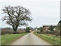
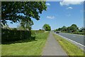
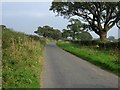
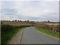

19 photos from this area
Area Information
Key information about the YO60 7JZ including its size, population, and administrative classification.
- Area Type
- Postcode
- Area Size
- 78.7 hectares
- Population
- 1697
- Population Density
- 28 people/km²
House Prices in YO60 7JZ
19
Properties
£384,100
Average Sold Price
£162,000
Lowest Price
£570,000
Highest Price
Showing 19 properties
| Address | Type | Beds | Baths | Last Sale Price | Last Sale Date | |
|---|---|---|---|---|---|---|
| Hilltop, Barton Hill To Barton Le Willows, Barton Hill, YO60 7JZ | Detached | 4 | 1 | £570,000 | Nov 2024 | |
| Rivendell, Barton Hill To Barton Le Willows, Barton Hill, YO60 7JZ | Detached | 4 | 2 | £555,500 | Jan 2021 | |
| Aspen House, Barton Hill To Barton Le Willows, Barton Hill, YO60 7JZ | Detached | 3 | 1 | £420,000 | May 2020 | |
| Kevril, Barton Hill To Barton Le Willows, Barton Hill, YO60 7JZ | Bungalow | 3 | - | £213,000 | Feb 2015 | |
| 6, Station Cottages, Barton Hill To Barton Le Willows, Barton Hill, YO60 7JZ | Terraced | 2 | 1 | £162,000 | Dec 2014 | |
| 3, Station Cottages, Barton Hill To Barton Le Willows, Barton Hill, YO60 7JZ | Terraced | 3 | 2 | - | - | |
| 5, Pokfulum, Station Cottages, Barton Hill To Barton Le Willows, Barton Hill, YO60 7JZ | Terraced | 2 | 1 | - | - | |
| 2, Gumeracha, Station Cottages, Barton Hill To Barton Le Willows, Barton Hill, YO60 7JZ | Semi-detached | 3 | - | - | - | |
| Glenroyd, Barton Hill To Barton Le Willows, Barton Hill, Malton, YO60 7JZ | Bungalow | - | - | - | - | |
| Glenroyd Garage, Barton Hill To Barton Le Willows, Barton Hill, YO60 7JZ | Industrial | - | - | - | - |
Page 1 of 2
Energy Efficiency in YO60 7JZ
Amenities
Schools
| Rank | School | Type | Entry gender | Ages |
|---|
Explore more schools in this area
Go to Schools tabDemographics
Household Size
Two person
most common
Accommodation Type
Houses
most common
Tenure
69
majority
Ethnic Group
White
most common
Religion
N/A
most common
Household Composition
N/A
most common
Age
47
median
Adults (30-64 years)
most common
Household Deprivation
N/A
with no deprivation
NS-SEC
39
in Lower managerial occupations
Explore more demographic insights in this area
Go to Demographics tabPlanning
Planning Constraints
- Flood RiskPremium
- Ramsar Wetland SitesPremium
- Area of Outstanding Natural BeautyPremium
- Protected Nature ReservePremium
- Protected WoodlandPremium