Area Overview for YO60 6RZ
Photos of YO60 6RZ
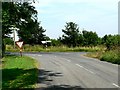
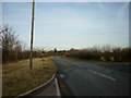
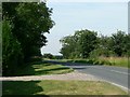
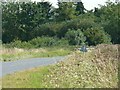
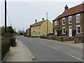
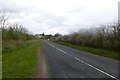
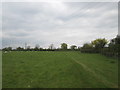
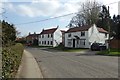
36 photos from this area
Area Information
Key information about the YO60 6RZ including its size, population, and administrative classification.
- Area Type
- Postcode
- Area Size
- 7.8 hectares
- Population
- 1762
- Population Density
- 37 people/km²
House Prices in YO60 6RZ
19
Properties
-
Average Sold Price
-
Lowest Price
-
Highest Price
Showing 19 properties
| Address | Type | Beds | Baths | Last Sale Price | Last Sale Date | |
|---|---|---|---|---|---|---|
| Office First Floor Headway House, 22 Dale Road, Sheriff Hutton, YO60 6RZ | office_workshop | - | - | - | - | |
| Sheriff House, 26 Dale Road, Sheriff Hutton, YO60 6RZ | general_industrial | - | - | - | - | |
| Unit 2 First Floor Sheriff House, 26 Dale Road, Sheriff Hutton, YO60 6RZ | Industrial | - | - | - | - | |
| Unit 4 First Floor Sheriff House, 26 Dale Road, Sheriff Hutton, YO60 6RZ | Office | - | - | - | - | |
| Unit 1 First Floor Sheriff House, 26 Dale Road, Sheriff Hutton, YO60 6RZ | Office | - | - | - | - | |
| Unit 3 First Floor Sheriff House, 26 Dale Road, Sheriff Hutton, YO60 6RZ | Office | - | - | - | - | |
| Unit 2A, Dale Road, Sheriff Hutton, YO60 6RZ | office_workshop | - | - | - | - | |
| Frozen In Time Ltd, 16-20 Dale Road, Sheriff Hutton, YO60 6RZ | storage_distribution | - | - | - | - | |
| Jak Marketing Ltd, 17 Dale Road, Sheriff Hutton, YO60 6RZ | general_industrial | - | - | - | - | |
| Atlas Autos, 1 Dale Road, Sheriff Hutton, YO60 6RZ | Industrial | - | - | - | - |
Page 1 of 2
Energy Efficiency in YO60 6RZ
Amenities
Schools
| Rank | School | Type | Entry gender | Ages |
|---|
Explore more schools in this area
Go to Schools tabDemographics
Household Size
Two person
most common
Accommodation Type
Houses
most common
Tenure
78
majority
Ethnic Group
White
most common
Religion
N/A
most common
Household Composition
N/A
most common
Age
47
median
Adults (30-64 years)
most common
Household Deprivation
N/A
with no deprivation
NS-SEC
41
in Lower managerial occupations
Explore more demographic insights in this area
Go to Demographics tabPlanning
Planning Constraints
- Flood RiskPremium
- Ramsar Wetland SitesPremium
- Area of Outstanding Natural BeautyPremium
- Protected Nature ReservePremium
- Protected WoodlandPremium