Area Overview for YO43 3YA
Photos of YO43 3YA
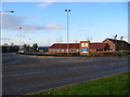
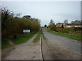
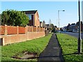
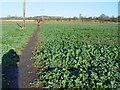
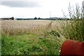
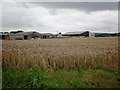
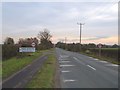
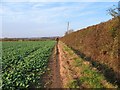

47 photos from this area
Area Information
Key information about the YO43 3YA including its size, population, and administrative classification.
- Area Type
- Postcode
- Area Size
- 2.0 hectares
- Population
- 1995
- Population Density
- 128 people/km²
House Prices in YO43 3YA
31
Properties
£201,497
Average Sold Price
£99,500
Lowest Price
£275,000
Highest Price
Showing 31 properties
| Address | Type | Beds | Baths | Last Sale Price | Last Sale Date | |
|---|---|---|---|---|---|---|
| 5 Millbeck Close, Market Weighton, YO43 3YA | house | - | - | £275,000 | Dec 2025 | |
| 12 Millbeck Close, Market Weighton, YO43 3YA | Bungalow | - | - | £232,500 | Dec 2024 | |
| 34 Millbeck Close, Market Weighton, YO43 3YA | Bungalow | - | - | £215,000 | Jul 2023 | |
| 21 Millbeck Close, Market Weighton, YO43 3YA | house | - | - | £225,000 | Jun 2022 | |
| 26 Millbeck Close, Market Weighton, YO43 3YA | Bungalow | - | - | £262,500 | Apr 2022 | |
| 6 Millbeck Close, Market Weighton, YO43 3YA | Bungalow | - | - | £203,750 | Dec 2021 | |
| 19 Millbeck Close, Market Weighton, YO43 3YA | Bungalow | - | - | £245,000 | Dec 2021 | |
| 15 Millbeck Close, Market Weighton, YO43 3YA | Bungalow | - | - | £235,000 | Apr 2021 | |
| 22 Millbeck Close, Market Weighton, YO43 3YA | Bungalow | - | - | £195,000 | Oct 2020 | |
| 16 Millbeck Close, Market Weighton, YO43 3YA | house | - | - | £229,950 | Jul 2020 |
Page 1 of 4
Energy Efficiency in YO43 3YA
Amenities
Schools
| Rank | School | Type | Entry gender | Ages |
|---|
Explore more schools in this area
Go to Schools tabDemographics
Household Size
Two person
most common
Accommodation Type
Houses
most common
Tenure
83
majority
Ethnic Group
White
most common
Religion
N/A
most common
Household Composition
N/A
most common
Age
47
median
Adults (30-64 years)
most common
Household Deprivation
N/A
with no deprivation
NS-SEC
42
in Lower managerial occupations
Explore more demographic insights in this area
Go to Demographics tabPlanning
Planning Constraints
- Flood RiskPremium
- Ramsar Wetland SitesPremium
- Area of Outstanding Natural BeautyPremium
- Protected Nature ReservePremium
- Protected WoodlandPremium