Area Overview for YO41 4BE
Photos of YO41 4BE
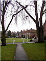
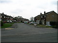
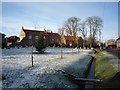
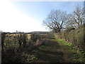
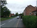
21 photos from this area
Area Information
Key information about the YO41 4BE including its size, population, and administrative classification.
- Area Type
- Postcode
- Area Size
- 2.4 hectares
- Population
- 1270
- Population Density
- 132 people/km²
House Prices in YO41 4BE
35
Properties
£240,848
Average Sold Price
£76,000
Lowest Price
£500,000
Highest Price
Showing 35 properties
| Address | Type | Beds | Baths | Last Sale Price | Last Sale Date | |
|---|---|---|---|---|---|---|
| Garton House, 31 Beckside, Elvington, York, YO41 4BE | Detached | 4 | 1 | £343,000 | Jul 2024 | |
| 37 Beckside, Elvington, York, YO41 4BE | Detached | 3 | 1 | £300,000 | Sep 2023 | |
| 27 Beckside, Elvington, York, YO41 4BE | house | 4 | 2 | £500,000 | Sep 2023 | |
| 28 Beckside, Elvington, York, YO41 4BE | Detached | 4 | 1 | £380,000 | Jul 2023 | |
| 6 Beckside, Elvington, York, YO41 4BE | Detached | 4 | 2 | £345,000 | Apr 2023 | |
| 2 Beckside, Elvington, York, YO41 4BE | Retail | 4 | 2 | £355,000 | Mar 2022 | |
| 1 Beckside, Elvington, York, YO41 4BE | Detached | 4 | 1 | £446,000 | Mar 2021 | |
| 4 Beckside, Elvington, York, YO41 4BE | Detached | 4 | - | £332,500 | Feb 2021 | |
| 15 Beckside, Elvington, York, YO41 4BE | Detached | 4 | 1 | £265,000 | Jan 2021 | |
| 20 Beckside, Elvington, York, YO41 4BE | Detached | 3 | 1 | £250,000 | Feb 2020 |
Page 1 of 4
Energy Efficiency in YO41 4BE
Amenities
Schools
| Rank | School | Type | Entry gender | Ages |
|---|
Explore more schools in this area
Go to Schools tabDemographics
Household Size
Two person
most common
Accommodation Type
Houses
most common
Tenure
83
majority
Ethnic Group
White
most common
Religion
N/A
most common
Household Composition
N/A
most common
Age
47
median
Adults (30-64 years)
most common
Household Deprivation
N/A
with no deprivation
NS-SEC
43
in Lower managerial occupations
Explore more demographic insights in this area
Go to Demographics tabPlanning
Planning Constraints
- Flood RiskPremium
- Ramsar Wetland SitesPremium
- Area of Outstanding Natural BeautyPremium
- Protected Nature ReservePremium
- Protected WoodlandPremium