Area Overview for YO41 4AA
Photos of YO41 4AA
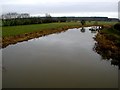
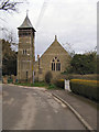
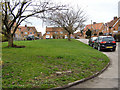

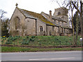

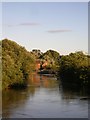
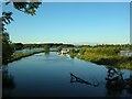

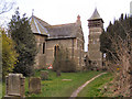
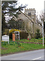

69 photos from this area
Area Information
Key information about the YO41 4AA including its size, population, and administrative classification.
- Area Type
- Postcode
- Area Size
- 67.4 hectares
- Population
- 1270
- Population Density
- 132 people/km²
House Prices in YO41 4AA
25
Properties
£322,559
Average Sold Price
£77,000
Lowest Price
£800,000
Highest Price
Showing 25 properties
| Address | Type | Beds | Baths | Last Sale Price | Last Sale Date | |
|---|---|---|---|---|---|---|
| Puutalo, Main Street, Elvington, York, YO41 4AA | Bungalow | - | - | £350,000 | Sep 2025 | |
| Derwent House, Main Street, Elvington, York, YO41 4AA | Detached | 5 | 2 | £800,000 | May 2025 | |
| Beech Cottage, Main Street, Elvington, York, YO41 4AA | Semi-detached | 2 | 1 | £275,000 | Dec 2023 | |
| Rose Cottage, Main Street, Elvington, York, YO41 4AA | Cottage | 2 | 1 | £216,000 | Mar 2021 | |
| The Hollies, Main Street, Elvington, York, YO41 4AA | Bungalow | 4 | 2 | £420,000 | Mar 2021 | |
| Ivy Cottage, Main Street, Elvington, York, YO41 4AA | house | 2 | - | £247,500 | Mar 2020 | |
| Derwent Cottage, Main Street, Elvington, York, YO41 4AA | house | - | - | £90,000 | Aug 2013 | |
| Eversfield, Main Street, Elvington, York, YO41 4AA | Bungalow | 5 | - | £365,000 | Nov 2012 | |
| Orchard House, Main Street, Elvington, York, YO41 4AA | house | - | - | £482,000 | Dec 2010 | |
| Rusdale, Main Street, Elvington, York, YO41 4AA | house | - | - | £392,000 | Feb 2010 |
Page 1 of 3
Energy Efficiency in YO41 4AA
Amenities
Schools
| Rank | School | Type | Entry gender | Ages |
|---|
Explore more schools in this area
Go to Schools tabDemographics
Household Size
Two person
most common
Accommodation Type
Houses
most common
Tenure
83
majority
Ethnic Group
White
most common
Religion
N/A
most common
Household Composition
N/A
most common
Age
47
median
Adults (30-64 years)
most common
Household Deprivation
N/A
with no deprivation
NS-SEC
43
in Lower managerial occupations
Explore more demographic insights in this area
Go to Demographics tabPlanning
Planning Constraints
- Flood RiskPremium
- Ramsar Wetland SitesPremium
- Area of Outstanding Natural BeautyPremium
- Protected Nature ReservePremium
- Protected WoodlandPremium