Area Overview for YO41 1EL
Photos of YO41 1EL


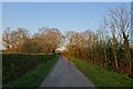
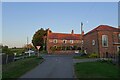
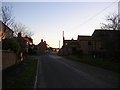
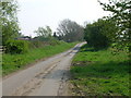
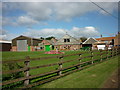
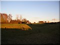
16 photos from this area
Area Information
Key information about the YO41 1EL including its size, population, and administrative classification.
- Area Type
- Postcode
- Area Size
- 10.8 hectares
- Population
- 1650
- Population Density
- 99 people/km²
House Prices in YO41 1EL
9
Properties
£292,500
Average Sold Price
£135,000
Lowest Price
£450,000
Highest Price
Showing 9 properties
| Address | Type | Beds | Baths | Last Sale Price | Last Sale Date | |
|---|---|---|---|---|---|---|
| Old Joiners Yard, Main Street, High Catton, YO41 1EL | Detached | - | - | £155,000 | Nov 2020 | |
| Chapel Bank House, Main Street, High Catton, YO41 1EL | house | - | - | £450,000 | Dec 2016 | |
| Holme Lea, 10 Main Street, High Catton, YO41 1EL | Detached | - | - | £317,500 | Feb 2016 | |
| Linden, 6 Main Street, High Catton, YO41 1EL | house | - | - | £405,000 | Aug 2010 | |
| 9 Main Street, High Catton, YO41 1EL | house | - | - | £135,000 | Aug 1997 | |
| Burton Gates Farm, Main Street, High Catton, YO41 1EL | Retail | 4 | 3 | - | - | |
| Caravan, Old Joiners Yard, Main Street, High Catton, YO41 1EL | Mobile Home | - | - | - | - | |
| Northcot, 7 Main Street, High Catton, YO41 1EL | Detached | - | - | - | - | |
| Prospect Farm, Main Street, High Catton, YO41 1EL | Detached | - | - | - | - |
Energy Efficiency in YO41 1EL
Amenities
Schools
| Rank | School | Type | Entry gender | Ages |
|---|
Explore more schools in this area
Go to Schools tabDemographics
Household Size
Two person
most common
Accommodation Type
Houses
most common
Tenure
86
majority
Ethnic Group
White
most common
Religion
N/A
most common
Household Composition
N/A
most common
Age
47
median
Adults (30-64 years)
most common
Household Deprivation
N/A
with no deprivation
NS-SEC
42
in Lower managerial occupations
Explore more demographic insights in this area
Go to Demographics tabPlanning
Planning Constraints
- Flood RiskPremium
- Ramsar Wetland SitesPremium
- Area of Outstanding Natural BeautyPremium
- Protected Nature ReservePremium
- Protected WoodlandPremium