Area Overview for YO32 5UZ
Photos of YO32 5UZ
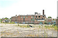
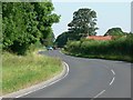
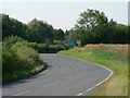
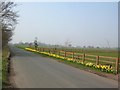
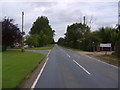
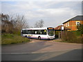
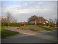
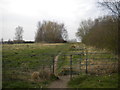
29 photos from this area
Area Information
Key information about the YO32 5UZ including its size, population, and administrative classification.
- Area Type
- Postcode
- Area Size
- 1.4 hectares
- Population
- 1399
- Population Density
- 188 people/km²
House Prices in YO32 5UZ
12
Properties
£284,556
Average Sold Price
£109,950
Lowest Price
£535,000
Highest Price
Showing 12 properties
| Address | Type | Beds | Baths | Last Sale Price | Last Sale Date | |
|---|---|---|---|---|---|---|
| 12 Brecks Lane, Strensall, York, YO32 5UZ | Retail | 3 | 1 | £342,000 | Jul 2022 | |
| 18 Brecks Lane, Strensall, York, YO32 5UZ | Detached | 4 | 2 | £355,000 | Feb 2021 | |
| Wickets Wood, Brecks Lane, Strensall, York, YO32 5UZ | Detached | 4 | - | £535,000 | Dec 2014 | |
| 8 Brecks Lane, Strensall, York, YO32 5UZ | Detached | 4 | 2 | £260,000 | Oct 2014 | |
| 10 Brecks Lane, Strensall, York, YO32 5UZ | Detached | 4 | - | £249,995 | Aug 2012 | |
| 16 Brecks Lane, Strensall, York, YO32 5UZ | Terraced | - | - | £139,950 | Jan 2003 | |
| 14 Brecks Lane, Strensall, York, YO32 5UZ | house | - | - | £109,950 | Aug 2002 | |
| 2, Brickyard Cottages, Brecks Lane, Strensall, York, YO32 5UZ | Semi-detached | 4 | - | - | - | |
| The Bungalow, 1 Brecks Lane, Strensall, York, YO32 5UZ | Detached | 4 | - | - | - | |
| Brickyard House, Brecks Lane, Strensall, York, YO32 5UZ | Detached | 3 | - | - | - |
Page 1 of 2
Energy Efficiency in YO32 5UZ
Amenities
Schools
| Rank | School | Type | Entry gender | Ages |
|---|
Explore more schools in this area
Go to Schools tabDemographics
Household Size
Family (3-5 people)
most common
Accommodation Type
Houses
most common
Tenure
90
majority
Ethnic Group
White
most common
Religion
N/A
most common
Household Composition
N/A
most common
Age
47
median
Adults (30-64 years)
most common
Household Deprivation
N/A
with no deprivation
NS-SEC
50
in Lower managerial occupations
Explore more demographic insights in this area
Go to Demographics tabPlanning
Planning Constraints
- Flood RiskPremium
- Ramsar Wetland SitesPremium
- Area of Outstanding Natural BeautyPremium
- Protected Nature ReservePremium
- Protected WoodlandPremium