Area Overview for YO32 4TT
Photos of YO32 4TT
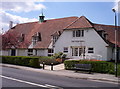
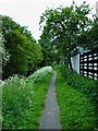
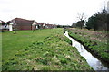
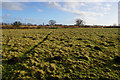
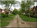
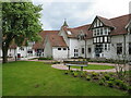
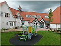
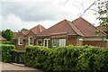
68 photos from this area
Area Information
Key information about the YO32 4TT including its size, population, and administrative classification.
- Area Type
- Postcode
- Area Size
- 6249 m²
- Population
- 1723
- Population Density
- 1467 people/km²
House Prices in YO32 4TT
22
Properties
£70,000
Average Sold Price
£17,500
Lowest Price
£268,000
Highest Price
Showing 22 properties
| Address | Type | Beds | Baths | Last Sale Price | Last Sale Date | |
|---|---|---|---|---|---|---|
| 6 Conifer Close, New Earswick, York, YO32 4TT | Semi-detached | 2 | 1 | £268,000 | Oct 2024 | |
| 21 Conifer Close, New Earswick, York, YO32 4TT | Semi-detached | - | - | £54,000 | Sep 2007 | |
| 5 Conifer Close, New Earswick, York, YO32 4TT | house | - | - | £30,000 | Feb 2003 | |
| 15 Conifer Close, New Earswick, York, YO32 4TT | Flat | - | - | £35,000 | Jan 2003 | |
| 17 Conifer Close, New Earswick, York, YO32 4TT | Flat | 2 | 1 | £34,500 | Dec 2001 | |
| 19 Conifer Close, New Earswick, York, YO32 4TT | house | - | - | £51,000 | Nov 2001 | |
| 4 Conifer Close, New Earswick, York, YO32 4TT | house | - | - | £17,500 | Nov 1999 | |
| 2 Conifer Close, New Earswick, York, YO32 4TT | Semi-detached | 2 | - | - | - | |
| 1 Conifer Close, New Earswick, York, YO32 4TT | house | - | - | - | - | |
| 11 Conifer Close, New Earswick, York, YO32 4TT | Flat | - | - | - | - |
Page 1 of 3
Energy Efficiency in YO32 4TT
Amenities
Schools
| Rank | School | Type | Entry gender | Ages |
|---|
Explore more schools in this area
Go to Schools tabDemographics
Household Size
Two person
most common
Accommodation Type
Houses
most common
Tenure
50
majority
Ethnic Group
White
most common
Religion
N/A
most common
Household Composition
N/A
most common
Age
47
median
Adults (30-64 years)
most common
Household Deprivation
N/A
with no deprivation
NS-SEC
29
in Lower managerial occupations
Explore more demographic insights in this area
Go to Demographics tabPlanning
Planning Constraints
- Flood RiskPremium
- Ramsar Wetland SitesPremium
- Area of Outstanding Natural BeautyPremium
- Protected Nature ReservePremium
- Protected WoodlandPremium