Area Overview for YO32 2PJ
Photos of YO32 2PJ
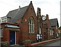
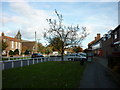
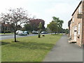
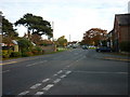
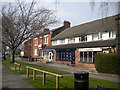
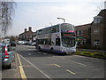
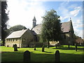
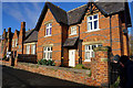
100 photos from this area
Area Information
Key information about the YO32 2PJ including its size, population, and administrative classification.
- Area Type
- Postcode
- Area Size
- 1.3 hectares
- Population
- 1555
- Population Density
- 4081 people/km²
House Prices in YO32 2PJ
21
Properties
£328,308
Average Sold Price
£146,000
Lowest Price
£490,000
Highest Price
Showing 21 properties
| Address | Type | Beds | Baths | Last Sale Price | Last Sale Date | |
|---|---|---|---|---|---|---|
| 14A The Village, Wigginton, York, YO32 2PJ | Bungalow | 2 | 1 | £330,000 | Jan 2023 | |
| 8 The Village, Wigginton, York, YO32 2PJ | Bungalow | 4 | 2 | £490,000 | May 2022 | |
| 24 The Village, Wigginton, York, YO32 2PJ | Semi-detached | 3 | 2 | £390,000 | Feb 2022 | |
| 28 The Village, Wigginton, York, YO32 2PJ | Detached | 4 | 2 | £437,500 | Mar 2018 | |
| 38 The Village, Wigginton, York, YO32 2PJ | Bungalow | 3 | - | £242,000 | Jan 2017 | |
| 20 The Village, Wigginton, York, YO32 2PJ | house | - | - | £270,000 | Oct 2015 | |
| 26 The Village, Wigginton, York, YO32 2PJ | Detached | 4 | - | £367,500 | Jun 2015 | |
| 34 The Village, Wigginton, York, YO32 2PJ | house | - | - | £330,000 | Jan 2010 | |
| Holly Dene, 14 The Village, Wigginton, York, YO32 2PJ | Detached | - | - | £440,000 | Mar 2008 | |
| 18 The Village, Wigginton, York, YO32 2PJ | Semi-detached | - | - | £295,000 | May 2007 |
Page 1 of 3
Energy Efficiency in YO32 2PJ
Amenities
Schools
| Rank | School | Type | Entry gender | Ages |
|---|
Explore more schools in this area
Go to Schools tabDemographics
Household Size
One person
most common
Accommodation Type
Houses
most common
Tenure
88
majority
Ethnic Group
White
most common
Religion
N/A
most common
Household Composition
N/A
most common
Age
47
median
Elderly (65+ years)
most common
Household Deprivation
N/A
with no deprivation
NS-SEC
39
in Lower managerial occupations
Explore more demographic insights in this area
Go to Demographics tabPlanning
Planning Constraints
- Flood RiskPremium
- Ramsar Wetland SitesPremium
- Area of Outstanding Natural BeautyPremium
- Protected Nature ReservePremium
- Protected WoodlandPremium