Area Overview for YO31 9DR
Photos of YO31 9DR

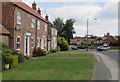
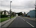
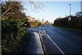

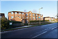

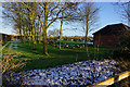
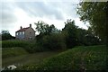
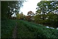
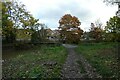

55 photos from this area
Area Information
Key information about the YO31 9DR including its size, population, and administrative classification.
- Area Type
- Postcode
- Area Size
- 5731 m²
- Population
- 1363
- Population Density
- 6836 people/km²
House Prices in YO31 9DR
20
Properties
£206,231
Average Sold Price
£55,500
Lowest Price
£438,550
Highest Price
Showing 20 properties
| Address | Type | Beds | Baths | Last Sale Price | Last Sale Date | |
|---|---|---|---|---|---|---|
| 5 Thornfield Drive, Huntington, York, YO31 9DR | Semi-detached | 3 | 1 | £270,000 | Jun 2025 | |
| 3 Thornfield Drive, Huntington, York, YO31 9DR | Semi-detached | 3 | 1 | £282,500 | Mar 2025 | |
| 21 Thornfield Drive, Huntington, York, YO31 9DR | Semi-detached | 3 | 1 | £220,000 | Mar 2024 | |
| 12 Thornfield Drive, Huntington, York, YO31 9DR | Semi-detached | 3 | 1 | £310,000 | Sep 2023 | |
| 7 Thornfield Drive, Huntington, York, YO31 9DR | Retail | 6 | 3 | £438,550 | Jul 2022 | |
| 4 Thornfield Drive, Huntington, York, YO31 9DR | house | - | - | £335,000 | Mar 2021 | |
| 10 Thornfield Drive, Huntington, York, YO31 9DR | Semi-detached | 3 | - | £237,500 | Dec 2016 | |
| 20 Thornfield Drive, Huntington, York, YO31 9DR | Semi-detached | - | - | £157,750 | Aug 2009 | |
| 17 Thornfield Drive, Huntington, York, YO31 9DR | Terraced | - | - | £170,000 | Dec 2007 | |
| 13 Thornfield Drive, Huntington, York, YO31 9DR | Semi-detached | - | - | £172,500 | Aug 2006 |
Page 1 of 2
Energy Efficiency in YO31 9DR
Amenities
Schools
| Rank | School | Type | Entry gender | Ages |
|---|
Explore more schools in this area
Go to Schools tabDemographics
Household Size
Two person
most common
Accommodation Type
Houses
most common
Tenure
90
majority
Ethnic Group
White
most common
Religion
N/A
most common
Household Composition
N/A
most common
Age
47
median
Adults (30-64 years)
most common
Household Deprivation
N/A
with no deprivation
NS-SEC
27
in Lower managerial occupations
Explore more demographic insights in this area
Go to Demographics tabPlanning
Planning Constraints
- Flood RiskPremium
- Ramsar Wetland SitesPremium
- Area of Outstanding Natural BeautyPremium
- Protected Nature ReservePremium
- Protected WoodlandPremium