Area Overview for YO31 7SX
Photos of YO31 7SX
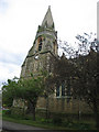
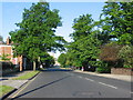
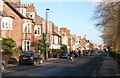
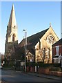
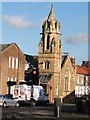

100 photos from this area
Area Information
Key information about the YO31 7SX including its size, population, and administrative classification.
- Area Type
- Postcode
- Area Size
- 2.5 hectares
- Population
- 1623
- Population Density
- 4687 people/km²
House Prices in YO31 7SX
14
Properties
£257,491
Average Sold Price
£66,950
Lowest Price
£810,000
Highest Price
Showing 14 properties
| Address | Type | Beds | Baths | Last Sale Price | Last Sale Date | |
|---|---|---|---|---|---|---|
| 51A Heworth Green, York, YO31 7SX | Semi-detached | 3 | 1 | £318,000 | Sep 2021 | |
| 7 Heworth Green, York, YO31 7SX | Semi-detached | 4 | 1 | £307,500 | Jan 2020 | |
| 51 Heworth Green, York, YO31 7SX | Semi-detached | 3 | 1 | £280,000 | Sep 2019 | |
| 13 Heworth Green, York, YO31 7SX | Semi-detached | 3 | 1 | £250,000 | Dec 2018 | |
| 35 Heworth Green, York, YO31 7SX | house | - | - | £810,000 | Sep 2018 | |
| 3 Heworth Green, York, YO31 7SX | Semi-detached | 5 | 2 | £267,500 | Jan 2018 | |
| 15 Heworth Green, York, YO31 7SX | house | 3 | - | £147,000 | Mar 2005 | |
| 9 Heworth Green, York, YO31 7SX | house | - | - | £135,000 | Apr 2003 | |
| 5 Heworth Green, York, YO31 7SX | house | - | - | £123,500 | Apr 2003 | |
| 11 Heworth Green, York, YO31 7SX | Semi-detached | - | - | £126,950 | Jul 2002 |
Page 1 of 2
Energy Efficiency in YO31 7SX
Amenities
Schools
| Rank | School | Type | Entry gender | Ages |
|---|
Explore more schools in this area
Go to Schools tabDemographics
Household Size
One person
most common
Accommodation Type
Houses
most common
Tenure
54
majority
Ethnic Group
White
most common
Religion
N/A
most common
Household Composition
N/A
most common
Age
47
median
Adults (30-64 years)
most common
Household Deprivation
N/A
with no deprivation
NS-SEC
32
in Lower managerial occupations
Explore more demographic insights in this area
Go to Demographics tabPlanning
Planning Constraints
- Flood RiskPremium
- Ramsar Wetland SitesPremium
- Area of Outstanding Natural BeautyPremium
- Protected Nature ReservePremium
- Protected WoodlandPremium