Area Overview for YO30 6JJ
Photos of YO30 6JJ
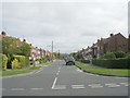
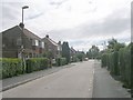
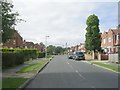
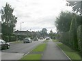
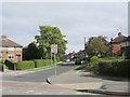
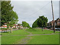
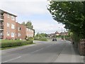
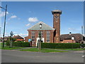
77 photos from this area
Area Information
Key information about the YO30 6JJ including its size, population, and administrative classification.
- Area Type
- Postcode
- Area Size
- 1.4 hectares
- Population
- 1394
- Population Density
- 8845 people/km²
House Prices in YO30 6JJ
52
Properties
£128,071
Average Sold Price
£20,500
Lowest Price
£250,000
Highest Price
Showing 52 properties
| Address | Type | Beds | Baths | Last Sale Price | Last Sale Date | |
|---|---|---|---|---|---|---|
| 37 Spalding Avenue, York, YO30 6JJ | Terraced | 3 | 1 | £245,000 | Dec 2025 | |
| 97 Spalding Avenue, York, YO30 6JJ | Terraced | 3 | 1 | £250,000 | Apr 2024 | |
| 49 Spalding Avenue, York, YO30 6JJ | Terraced | 2 | 1 | £230,000 | Dec 2022 | |
| 11 Spalding Avenue, York, YO30 6JJ | house | - | - | £147,500 | Nov 2018 | |
| 55 Spalding Avenue, York, YO30 6JJ | Terraced | 3 | - | £139,995 | Jun 2014 | |
| 15 Spalding Avenue, York, YO30 6JJ | house | 3 | - | £119,000 | Oct 2013 | |
| 87 Spalding Avenue, York, YO30 6JJ | Terraced | 3 | 1 | £135,000 | Oct 2007 | |
| 63 Spalding Avenue, York, YO30 6JJ | Terraced | - | - | £128,000 | Mar 2007 | |
| 83 Spalding Avenue, York, YO30 6JJ | Terraced | - | - | £123,500 | Jun 2005 | |
| 65 Spalding Avenue, York, YO30 6JJ | house | - | - | £119,000 | Jan 2005 |
Page 1 of 6
Energy Efficiency in YO30 6JJ
Amenities
Schools
| Rank | School | Type | Entry gender | Ages |
|---|
Explore more schools in this area
Go to Schools tabDemographics
Household Size
Family (3-5 people)
most common
Accommodation Type
Houses
most common
Tenure
40
majority
Ethnic Group
White
most common
Religion
N/A
most common
Household Composition
N/A
most common
Age
47
median
Adults (30-64 years)
most common
Household Deprivation
N/A
with no deprivation
NS-SEC
16
in Lower managerial occupations
Explore more demographic insights in this area
Go to Demographics tabPlanning
Planning Constraints
- Flood RiskPremium
- Ramsar Wetland SitesPremium
- Area of Outstanding Natural BeautyPremium
- Protected Nature ReservePremium
- Protected WoodlandPremium