Area Overview for YO30 5QB
Photos of YO30 5QB
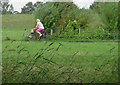
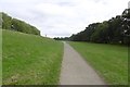
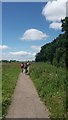
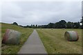
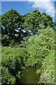
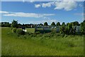
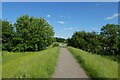
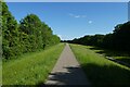
69 photos from this area
Area Information
Key information about the YO30 5QB including its size, population, and administrative classification.
- Area Type
- Postcode
- Area Size
- 8319 m²
- Population
- 1443
- Population Density
- 6439 people/km²
House Prices in YO30 5QB
14
Properties
£148,115
Average Sold Price
£20,800
Lowest Price
£292,000
Highest Price
Showing 14 properties
| Address | Type | Beds | Baths | Last Sale Price | Last Sale Date | |
|---|---|---|---|---|---|---|
| 50 Rawcliffe Lane, York, YO30 5QB | Semi-detached | 3 | 2 | £292,000 | Oct 2015 | |
| 46 Rawcliffe Lane, York, YO30 5QB | Detached | - | - | £280,000 | Dec 2004 | |
| 48 Rawcliffe Lane, York, YO30 5QB | Semi-detached | 3 | - | £20,800 | Sep 1999 | |
| 42 Rawcliffe Lane, York, YO30 5QB | Detached | - | - | £80,555 | Oct 1998 | |
| 44 Rawcliffe Lane, York, YO30 5QB | Detached | 5 | 2 | £137,500 | Jun 1998 | |
| 34 Rawcliffe Lane, York, YO30 5QB | Semi-detached | - | - | £156,000 | Feb 1998 | |
| 54 Rawcliffe Lane, York, YO30 5QB | Bungalow | - | - | £69,950 | May 1995 | |
| 40 Rawcliffe Lane, York, YO30 5QB | Semi-detached | 4 | 2 | - | - | |
| 56 Rawcliffe Lane, York, YO30 5QB | Semi-detached | 3 | 2 | - | - | |
| 58 Rawcliffe Lane, York, YO30 5QB | Retail | 3 | 1 | - | - |
Page 1 of 2
Energy Efficiency in YO30 5QB
Amenities
Schools
| Rank | School | Type | Entry gender | Ages |
|---|
Explore more schools in this area
Go to Schools tabDemographics
Household Size
Two person
most common
Accommodation Type
Houses
most common
Tenure
83
majority
Ethnic Group
White
most common
Religion
N/A
most common
Household Composition
N/A
most common
Age
47
median
Adults (30-64 years)
most common
Household Deprivation
N/A
with no deprivation
NS-SEC
35
in Lower managerial occupations
Explore more demographic insights in this area
Go to Demographics tabPlanning
Planning Constraints
- Flood RiskPremium
- Ramsar Wetland SitesPremium
- Area of Outstanding Natural BeautyPremium
- Protected Nature ReservePremium
- Protected WoodlandPremium