Area Overview for YO26 8ER
Photos of YO26 8ER
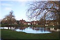
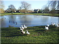
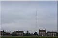
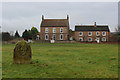
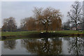

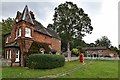
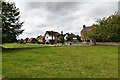
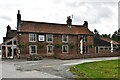
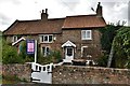
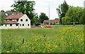
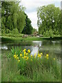
42 photos from this area
Area Information
Key information about the YO26 8ER including its size, population, and administrative classification.
- Area Type
- Postcode
- Area Size
- 7.4 hectares
- Population
- 2421
- Population Density
- 64 people/km²
House Prices in YO26 8ER
22
Properties
£620,625
Average Sold Price
£167,500
Lowest Price
£960,000
Highest Price
Showing 22 properties
| Address | Type | Beds | Baths | Last Sale Price | Last Sale Date | |
|---|---|---|---|---|---|---|
| Blacksmiths Cottage, The Green, Nun Monkton Village, Nun Monkton, YO26 8ER | Detached | 4 | - | £960,000 | Jul 2022 | |
| Field House, Nun Monkton Village, Nun Monkton, YO26 8ER | house | 4 | - | £875,000 | Aug 2018 | |
| Lea House, Nun Monkton Village, Nun Monkton, YO26 8ER | house | - | - | £480,000 | Jan 2011 | |
| The Old School House, The Green, Nun Monkton Village, Nun Monkton, YO26 8ER | house | - | - | £167,500 | Oct 1997 | |
| Croft House, The Green, Nun Monkton Village, Nun Monkton, YO26 8ER | Detached | 4 | 2 | - | - | |
| Vicarage Cottage, The Green, Nun Monkton Village, Nun Monkton, YO26 8ER | Detached | 4 | 2 | - | - | |
| Syke Cottage, The Green, Nun Monkton Village, Nun Monkton, YO26 8ER | Detached | 5 | 3 | - | - | |
| Garth Cottage, The Green, Nun Monkton Village, Nun Monkton, YO26 8ER | Detached | 2 | 1 | - | - | |
| White Swan House, The Green, Nun Monkton Village, Nun Monkton, YO26 8ER | Detached | 5 | - | - | - | |
| Flat, Savage Garth, Nun Monkton Village, Nun Monkton, YO26 8ER | Flat | - | - | - | - |
Page 1 of 3
Energy Efficiency in YO26 8ER
Amenities
Schools
| Rank | School | Type | Entry gender | Ages |
|---|
Explore more schools in this area
Go to Schools tabDemographics
Household Size
Two person
most common
Accommodation Type
Houses
most common
Tenure
80
majority
Ethnic Group
White
most common
Religion
N/A
most common
Household Composition
N/A
most common
Age
22
median
Adults (30-64 years)
most common
Household Deprivation
N/A
with no deprivation
NS-SEC
39
in Lower managerial occupations
Explore more demographic insights in this area
Go to Demographics tabPlanning
Planning Constraints
- Flood RiskPremium
- Ramsar Wetland SitesPremium
- Area of Outstanding Natural BeautyPremium
- Protected Nature ReservePremium
- Protected WoodlandPremium