Area Overview for YO26 7SB
Photos of YO26 7SB
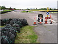
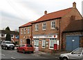
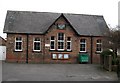
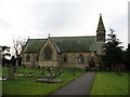
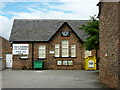
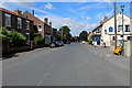
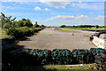
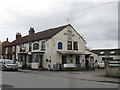
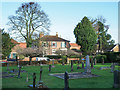
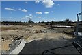
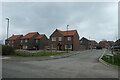
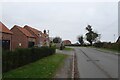
32 photos from this area
Area Information
Key information about the YO26 7SB including its size, population, and administrative classification.
- Area Type
- Postcode
- Area Size
- 1.9 hectares
- Population
- 1788
- Population Density
- 248 people/km²
House Prices in YO26 7SB
44
Properties
£294,021
Average Sold Price
£101,985
Lowest Price
£412,500
Highest Price
Showing 44 properties
| Address | Type | Beds | Baths | Last Sale Price | Last Sale Date | |
|---|---|---|---|---|---|---|
| 36 Bunting Drive, Tockwith, YO26 7SB | house | - | - | £412,500 | Apr 2025 | |
| 49 Bunting Drive, Tockwith, YO26 7SB | Semi-detached | 3 | 2 | £265,000 | Mar 2024 | |
| 3 Bunting Drive, Tockwith, YO26 7SB | house | - | - | £285,000 | Mar 2022 | |
| 1 Bunting Drive, Tockwith, YO26 7SB | Semi-detached | 3 | 1 | £295,950 | Nov 2020 | |
| 6 Bunting Drive, Tockwith, YO26 7SB | house | - | - | £101,985 | Nov 2020 | |
| 47 Bunting Drive, Tockwith, YO26 7SB | Semi-detached | 3 | 2 | £239,950 | Sep 2020 | |
| 38 Bunting Drive, Tockwith, YO26 7SB | house | - | - | £339,950 | Sep 2020 | |
| 27 Bunting Drive, Tockwith, YO26 7SB | house | - | - | £375,000 | Sep 2020 | |
| 33 Bunting Drive, Tockwith, YO26 7SB | house | 4 | 2 | £379,000 | Aug 2020 | |
| 34 Bunting Drive, Tockwith, YO26 7SB | Detached | 3 | 2 | £249,950 | Aug 2020 |
Page 1 of 5
Energy Efficiency in YO26 7SB
Amenities
Schools
| Rank | School | Type | Entry gender | Ages |
|---|
Explore more schools in this area
Go to Schools tabDemographics
Household Size
Two person
most common
Accommodation Type
Houses
most common
Tenure
82
majority
Ethnic Group
White
most common
Religion
N/A
most common
Household Composition
N/A
most common
Age
47
median
Adults (30-64 years)
most common
Household Deprivation
N/A
with no deprivation
NS-SEC
46
in Lower managerial occupations
Explore more demographic insights in this area
Go to Demographics tabPlanning
Planning Constraints
- Flood RiskPremium
- Ramsar Wetland SitesPremium
- Area of Outstanding Natural BeautyPremium
- Protected Nature ReservePremium
- Protected WoodlandPremium