Area Overview for YO26 4UN
Photos of YO26 4UN
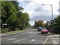
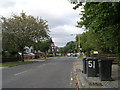
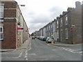
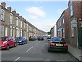
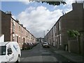
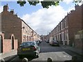
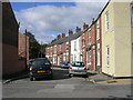
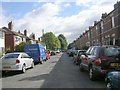
100 photos from this area
Area Information
Key information about the YO26 4UN including its size, population, and administrative classification.
- Area Type
- Postcode
- Area Size
- 4316 m²
- Population
- 1486
- Population Density
- 5823 people/km²
House Prices in YO26 4UN
23
Properties
£189,944
Average Sold Price
£41,000
Lowest Price
£299,260
Highest Price
Showing 23 properties
| Address | Type | Beds | Baths | Last Sale Price | Last Sale Date | |
|---|---|---|---|---|---|---|
| 139 Poppleton Road, York, YO26 4UN | Terraced | 2 | 1 | £295,000 | Oct 2023 | |
| 91 Poppleton Road, York, YO26 4UN | house | - | - | £249,999 | Aug 2023 | |
| 133 Poppleton Road, York, YO26 4UN | house | 3 | - | £299,260 | Aug 2022 | |
| 127 Poppleton Road, York, YO26 4UN | house | - | - | £195,000 | Mar 2022 | |
| 131 Poppleton Road, York, YO26 4UN | house | - | - | £215,000 | Jun 2021 | |
| 111 Poppleton Road, York, YO26 4UN | Terraced | 1 | 1 | £143,500 | Aug 2020 | |
| 115 Poppleton Road, York, YO26 4UN | house | - | - | £216,000 | Aug 2018 | |
| 135 Poppleton Road, York, YO26 4UN | Terraced | - | - | £202,500 | May 2018 | |
| 125 Poppleton Road, York, YO26 4UN | Terraced | 3 | 1 | £213,000 | Jul 2017 | |
| 109A Poppleton Road, York, YO26 4UN | Flat | - | - | £190,000 | Jan 2011 |
Page 1 of 3
Energy Efficiency in YO26 4UN
Amenities
Schools
| Rank | School | Type | Entry gender | Ages |
|---|
Explore more schools in this area
Go to Schools tabDemographics
Household Size
Two person
most common
Accommodation Type
Houses
most common
Tenure
64
majority
Ethnic Group
White
most common
Religion
N/A
most common
Household Composition
N/A
most common
Age
47
median
Adults (30-64 years)
most common
Household Deprivation
N/A
with no deprivation
NS-SEC
38
in Lower managerial occupations
Explore more demographic insights in this area
Go to Demographics tabPlanning
Planning Constraints
- Flood RiskPremium
- Ramsar Wetland SitesPremium
- Area of Outstanding Natural BeautyPremium
- Protected Nature ReservePremium
- Protected WoodlandPremium