Area Overview for YO25 9JE
Photos of YO25 9JE
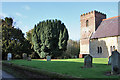
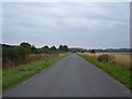
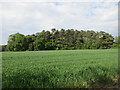
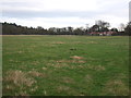
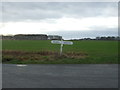
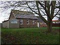
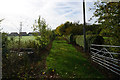
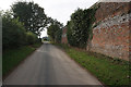
41 photos from this area
Area Information
Key information about the YO25 9JE including its size, population, and administrative classification.
- Area Type
- Postcode
- Area Size
- 1.9 hectares
- Population
- 1484
- Population Density
- 35 people/km²
House Prices in YO25 9JE
21
Properties
£237,067
Average Sold Price
£123,000
Lowest Price
£490,000
Highest Price
Showing 21 properties
| Address | Type | Beds | Baths | Last Sale Price | Last Sale Date | |
|---|---|---|---|---|---|---|
| 12 School Lane, Kilnwick, YO25 9JE | Semi-detached | 3 | 1 | £225,000 | Jul 2025 | |
| 20 School Lane, Kilnwick, YO25 9JE | Semi-detached | 3 | 1 | £210,000 | Aug 2024 | |
| Westholme, 9 School Lane, Kilnwick, YO25 9JE | Semi-detached | 4 | 1 | £490,000 | May 2024 | |
| Greenhop, 15 School Lane, Kilnwick, YO25 9JE | Bungalow | 3 | 2 | £257,000 | Sep 2021 | |
| 14 School Lane, Kilnwick, YO25 9JE | house | - | - | £152,500 | Dec 2020 | |
| Chapel House, 1 School Lane, Kilnwick, YO25 9JE | Detached | 3 | 3 | £360,000 | May 2020 | |
| 17 School Lane, Kilnwick, YO25 9JE | house | - | - | £125,000 | Mar 2020 | |
| The Conifers, 3 School Lane, Kilnwick, YO25 9JE | Semi-detached | 4 | 2 | £183,000 | Dec 2018 | |
| 11 School Lane, Kilnwick, YO25 9JE | house | - | - | £155,000 | Nov 2013 | |
| Leyela, 24 School Lane, Kilnwick, YO25 9JE | house | - | - | £123,000 | Sep 2010 |
Page 1 of 3
Energy Efficiency in YO25 9JE
Amenities
Schools
| Rank | School | Type | Entry gender | Ages |
|---|
Explore more schools in this area
Go to Schools tabDemographics
Household Size
Two person
most common
Accommodation Type
Houses
most common
Tenure
79
majority
Ethnic Group
White
most common
Religion
N/A
most common
Household Composition
N/A
most common
Age
47
median
Adults (30-64 years)
most common
Household Deprivation
N/A
with no deprivation
NS-SEC
39
in Lower managerial occupations
Explore more demographic insights in this area
Go to Demographics tabPlanning
Planning Constraints
- Flood RiskPremium
- Ramsar Wetland SitesPremium
- Area of Outstanding Natural BeautyPremium
- Protected Nature ReservePremium
- Protected WoodlandPremium