Area Overview for YO25 8TH
Photos of YO25 8TH
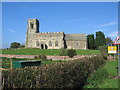
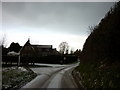


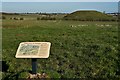
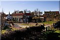
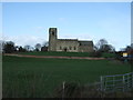
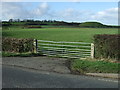
71 photos from this area
Area Information
Key information about the YO25 8TH including its size, population, and administrative classification.
- Area Type
- Postcode
- Area Size
- 20.0 hectares
- Population
- 1529
- Population Density
- 41 people/km²
House Prices in YO25 8TH
14
Properties
£378,738
Average Sold Price
£235,000
Lowest Price
£499,950
Highest Price
Showing 14 properties
| Address | Type | Beds | Baths | Last Sale Price | Last Sale Date | |
|---|---|---|---|---|---|---|
| Old Buck Inn, Beeford Road, Skipsea Brough, YO25 8TH | Detached | 4 | 1 | £370,000 | Feb 2023 | |
| Fourways, Bewholme Lane, Skipsea Brough, YO25 8TH | Bungalow | - | - | £410,000 | Jan 2023 | |
| Brough House, Beeford Road, Skipsea Brough, YO25 8TH | house | 4 | - | £499,950 | Aug 2022 | |
| Castle House, Beeford Road, Skipsea Brough, YO25 8TH | Detached | 4 | 2 | £235,000 | Nov 2013 | |
| 1 Beeford Road, Skipsea Brough, YO25 8TH | house | 2 | 1 | - | - | |
| 1, Eastside Cottages, Beeford Road, Skipsea Brough, YO25 8TH | Retail | 1 | 1 | - | - | |
| 2, Eastside Cottages, Beeford Road, Skipsea Brough, YO25 8TH | Retail | 2 | 1 | - | - | |
| Paddock View, 2 Beeford Road, Skipsea Brough, YO25 8TH | Semi-detached | 4 | 2 | - | - | |
| Long Cottage, Beeford Road, Skipsea Brough, YO25 8TH | Detached | - | - | - | - | |
| Forge Cottage, Beeford Road, Skipsea Brough, YO25 8TH | Detached | - | - | - | - |
Page 1 of 2
Energy Efficiency in YO25 8TH
Amenities
Schools
| Rank | School | Type | Entry gender | Ages |
|---|
Explore more schools in this area
Go to Schools tabDemographics
Household Size
Two person
most common
Accommodation Type
Houses
most common
Tenure
74
majority
Ethnic Group
White
most common
Religion
N/A
most common
Household Composition
N/A
most common
Age
47
median
Adults (30-64 years)
most common
Household Deprivation
N/A
with no deprivation
NS-SEC
25
in Lower managerial occupations
Explore more demographic insights in this area
Go to Demographics tabPlanning
Planning Constraints
- Flood RiskPremium
- Ramsar Wetland SitesPremium
- Area of Outstanding Natural BeautyPremium
- Protected Nature ReservePremium
- Protected WoodlandPremium