Area Overview for YO25 8DH
Photos of YO25 8DH
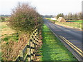


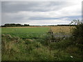
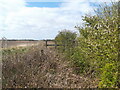
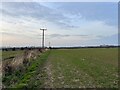

10 photos from this area
Area Information
Key information about the YO25 8DH including its size, population, and administrative classification.
- Area Type
- Postcode
- Area Size
- 93.1 hectares
- Population
- 2242
- Population Density
- 47 people/km²
House Prices in YO25 8DH
28
Properties
£259,605
Average Sold Price
£69,000
Lowest Price
£475,000
Highest Price
Showing 28 properties
| Address | Type | Beds | Baths | Last Sale Price | Last Sale Date | |
|---|---|---|---|---|---|---|
| Primrose Lodge, Church Lane, Atwick, YO25 8DH | Semi-detached | 4 | 3 | £395,000 | Mar 2024 | |
| Norton, Church Lane, Atwick, YO25 8DH | Bungalow | 3 | 1 | £475,000 | Nov 2022 | |
| Vicarage Farm, Church Lane, Atwick, YO25 8DH | house | 5 | - | £310,000 | Nov 2022 | |
| Fosse Bank, Church Lane, Atwick, YO25 8DH | Bungalow | 3 | 1 | £320,000 | Jun 2021 | |
| Gardenia Cottage, Church Lane, Atwick, YO25 8DH | house | - | - | £310,126 | May 2021 | |
| Tall Trees, Church Lane, Atwick, YO25 8DH | Detached | 4 | 4 | £365,000 | Oct 2020 | |
| Tuksumduin, Church Lane, Atwick, YO25 8DH | Detached | 4 | 2 | £337,500 | Sep 2020 | |
| Field House, Church Lane, Atwick, YO25 8DH | Detached | 4 | 3 | £285,000 | Aug 2018 | |
| Breeze Cottage, Church Lane, Atwick, YO25 8DH | Bungalow | - | - | £152,500 | Apr 2016 | |
| Hawcroft, 7 Church Lane, Atwick, YO25 8DH | Bungalow | 2 | 1 | £150,000 | Jun 2015 |
Page 1 of 3
Energy Efficiency in YO25 8DH
Amenities
Schools
| Rank | School | Type | Entry gender | Ages |
|---|
Explore more schools in this area
Go to Schools tabDemographics
Household Size
Two person
most common
Accommodation Type
Houses
most common
Tenure
76
majority
Ethnic Group
White
most common
Religion
N/A
most common
Household Composition
N/A
most common
Age
47
median
Adults (30-64 years)
most common
Household Deprivation
N/A
with no deprivation
NS-SEC
32
in Lower managerial occupations
Explore more demographic insights in this area
Go to Demographics tabPlanning
Planning Constraints
- Flood RiskPremium
- Ramsar Wetland SitesPremium
- Area of Outstanding Natural BeautyPremium
- Protected Nature ReservePremium
- Protected WoodlandPremium