Area Overview for YO25 6RR
Photos of YO25 6RR
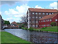
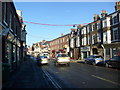
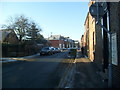
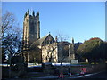
100 photos from this area
Area Information
Key information about the YO25 6RR including its size, population, and administrative classification.
- Area Type
- Postcode
- Area Size
- 9804 m²
- Population
- 1515
- Population Density
- 1987 people/km²
House Prices in YO25 6RR
11
Properties
£273,431
Average Sold Price
£87,500
Lowest Price
£399,950
Highest Price
Showing 11 properties
| Address | Type | Beds | Baths | Last Sale Price | Last Sale Date | |
|---|---|---|---|---|---|---|
| 3 Wold View Road South, Driffield, YO25 6RR | house | 3 | 2 | £220,000 | Apr 2022 | |
| Copperfields, Wold View Road South, Driffield, YO25 6RR | Bungalow | 3 | 2 | £355,000 | Sep 2021 | |
| 5 Wold View Road South, Driffield, YO25 6RR | Detached | 4 | 2 | £380,000 | Oct 2019 | |
| 5A Wold View Road South, Driffield, YO25 6RR | Detached | 4 | 2 | £370,000 | Feb 2017 | |
| 8 Wold View Road South, Driffield, YO25 6RR | Detached | - | - | £100,000 | Feb 2010 | |
| Lyncroft, Wold View Road South, Driffield, YO25 6RR | Detached | 3 | 2 | £275,000 | Sep 2007 | |
| 6 Wold View Road South, Driffield, YO25 6RR | Detached | 5 | 2 | £399,950 | Jul 2006 | |
| Brelades, 2 Wold View Road South, Driffield, YO25 6RR | Detached | - | - | £87,500 | Oct 1997 | |
| 4 Wold View Road South, Driffield, YO25 6RR | Detached | - | - | - | - | |
| 7 Wold View Road South, Driffield, YO25 6RR | Detached | - | - | - | - |
Page 1 of 2
Energy Efficiency in YO25 6RR
Amenities
Schools
| Rank | School | Type | Entry gender | Ages |
|---|
Explore more schools in this area
Go to Schools tabDemographics
Household Size
One person
most common
Accommodation Type
Houses
most common
Tenure
66
majority
Ethnic Group
White
most common
Religion
N/A
most common
Household Composition
N/A
most common
Age
47
median
Adults (30-64 years)
most common
Household Deprivation
N/A
with no deprivation
NS-SEC
33
in Lower managerial occupations
Explore more demographic insights in this area
Go to Demographics tabPlanning
Planning Constraints
- Flood RiskPremium
- Ramsar Wetland SitesPremium
- Area of Outstanding Natural BeautyPremium
- Protected Nature ReservePremium
- Protected WoodlandPremium