Area Overview for YO25 5GE
Photos of YO25 5GE
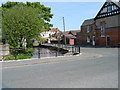
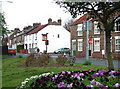
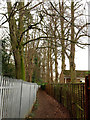
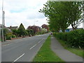
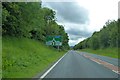
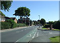
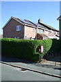
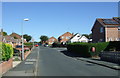
46 photos from this area
Area Information
Key information about the YO25 5GE including its size, population, and administrative classification.
- Area Type
- Postcode
- Area Size
- 2.1 hectares
- Population
- 1567
- Population Density
- 420 people/km²
House Prices in YO25 5GE
61
Properties
£231,292
Average Sold Price
£65,625
Lowest Price
£2,001,550
Highest Price
Showing 61 properties
| Address | Type | Beds | Baths | Last Sale Price | Last Sale Date | |
|---|---|---|---|---|---|---|
| 22 Nalton Drive, Driffield, YO25 5GE | house | - | - | £109,000 | Oct 2025 | |
| 33 Nalton Drive, Driffield, YO25 5GE | house | - | - | £260,000 | Oct 2025 | |
| 21 Nalton Drive, Driffield, YO25 5GE | Detached | 3 | 2 | £235,000 | Jan 2025 | |
| 30 Nalton Drive, Driffield, YO25 5GE | Semi-detached | 3 | 1 | £175,000 | Dec 2024 | |
| 4 Nalton Drive, Driffield, YO25 5GE | house | - | - | £259,950 | Sep 2024 | |
| 3 Nalton Drive, Driffield, YO25 5GE | Semi-detached | 3 | 2 | £210,000 | Jul 2024 | |
| 36 Nalton Drive, Driffield, YO25 5GE | house | - | - | £285,000 | Apr 2024 | |
| 10 Nalton Drive, Driffield, YO25 5GE | Semi-detached | 3 | 2 | £185,000 | Mar 2024 | |
| 31 Nalton Drive, Driffield, YO25 5GE | house | - | - | £245,000 | Feb 2024 | |
| 9 Nalton Drive, Driffield, YO25 5GE | Detached | 4 | 2 | £261,000 | Jan 2024 |
Page 1 of 7
Energy Efficiency in YO25 5GE
Amenities
Schools
| Rank | School | Type | Entry gender | Ages |
|---|
Explore more schools in this area
Go to Schools tabDemographics
Household Size
Two person
most common
Accommodation Type
Houses
most common
Tenure
86
majority
Ethnic Group
White
most common
Religion
N/A
most common
Household Composition
N/A
most common
Age
47
median
Adults (30-64 years)
most common
Household Deprivation
N/A
with no deprivation
NS-SEC
31
in Lower managerial occupations
Explore more demographic insights in this area
Go to Demographics tabPlanning
Planning Constraints
- Flood RiskPremium
- Ramsar Wetland SitesPremium
- Area of Outstanding Natural BeautyPremium
- Protected Nature ReservePremium
- Protected WoodlandPremium