Area Overview for YO25 5AY
Photos of YO25 5AY
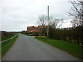
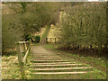
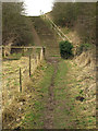
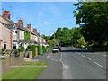
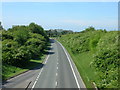
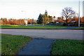
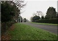
47 photos from this area
Area Information
Key information about the YO25 5AY including its size, population, and administrative classification.
- Area Type
- Postcode
- Area Size
- 1.9 hectares
- Population
- 1676
- Population Density
- 2546 people/km²
House Prices in YO25 5AY
43
Properties
£171,696
Average Sold Price
£55,950
Lowest Price
£357,500
Highest Price
Showing 43 properties
| Address | Type | Beds | Baths | Last Sale Price | Last Sale Date | |
|---|---|---|---|---|---|---|
| 93 York Road, Driffield, YO25 5AY | house | 3 | 1 | £218,000 | Dec 2025 | |
| 27 York Road, Driffield, YO25 5AY | house | 3 | 1 | £220,000 | Nov 2025 | |
| 53 York Road, Driffield, YO25 5AY | Semi-detached | 3 | 1 | £223,000 | Oct 2025 | |
| Spellowgate Lodge, York Road, Driffield, YO25 5AY | Retail | 2 | 1 | £275,000 | Jun 2022 | |
| 95 York Road, Driffield, YO25 5AY | house | 3 | 1 | £200,500 | May 2022 | |
| 41 York Road, Driffield, YO25 5AY | Semi-detached | 3 | 1 | £249,950 | Apr 2022 | |
| 77 York Road, Driffield, YO25 5AY | house | - | - | £196,000 | Sep 2021 | |
| 79 York Road, Driffield, YO25 5AY | house | - | - | £185,000 | Feb 2021 | |
| 89 York Road, Driffield, YO25 5AY | house | - | - | £163,000 | Nov 2020 | |
| 37 York Road, Driffield, YO25 5AY | Semi-detached | 3 | 1 | £190,000 | Sep 2020 |
Page 1 of 5
Energy Efficiency in YO25 5AY
Amenities
Schools
| Rank | School | Type | Entry gender | Ages |
|---|
Explore more schools in this area
Go to Schools tabDemographics
Household Size
Two person
most common
Accommodation Type
Houses
most common
Tenure
90
majority
Ethnic Group
White
most common
Religion
N/A
most common
Household Composition
N/A
most common
Age
47
median
Adults (30-64 years)
most common
Household Deprivation
N/A
with no deprivation
NS-SEC
37
in Lower managerial occupations
Explore more demographic insights in this area
Go to Demographics tabPlanning
Planning Constraints
- Flood RiskPremium
- Ramsar Wetland SitesPremium
- Area of Outstanding Natural BeautyPremium
- Protected Nature ReservePremium
- Protected WoodlandPremium