Area Overview for YO25 4ST
Photos of YO25 4ST
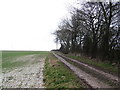
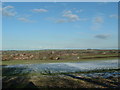
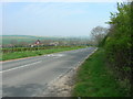
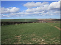
10 photos from this area
Area Information
Key information about the YO25 4ST including its size, population, and administrative classification.
- Area Type
- Postcode
- Area Size
- 60.7 hectares
- Population
- 1582
- Population Density
- 33 people/km²
House Prices in YO25 4ST
41
Properties
£230,078
Average Sold Price
£37,500
Lowest Price
£385,000
Highest Price
Showing 41 properties
| Address | Type | Beds | Baths | Last Sale Price | Last Sale Date | |
|---|---|---|---|---|---|---|
| Applegarth, South Side, Kilham, YO25 4ST | house | - | - | £235,000 | Jun 2021 | |
| Ashburn Cottage, South Side, Kilham, YO25 4ST | Semi-detached | 3 | 1 | £210,000 | Apr 2021 | |
| Peake House, South Side, Kilham, YO25 4ST | Detached | - | - | £143,000 | Mar 2021 | |
| Berriman House, South Side, Kilham, YO25 4ST | Detached | 4 | 2 | £325,000 | Jul 2019 | |
| Wychelms, South Side, Kilham, YO25 4ST | Bungalow | 3 | 1 | £259,435 | May 2019 | |
| Craddock Cottage, South Side, Kilham, YO25 4ST | Detached | 4 | 2 | £297,000 | Apr 2017 | |
| Oakhurst, South Side, Kilham, YO25 4ST | Detached | 4 | - | £385,000 | Dec 2010 | |
| South Side Farm, South Side, Kilham, YO25 4ST | Detached | - | - | £199,000 | Jul 2009 | |
| Richmond House, South Side, Kilham, YO25 4ST | Detached | - | - | £345,000 | Nov 2006 | |
| Willow Cottage, South Side, Kilham, YO25 4ST | house | - | - | £150,000 | Oct 2004 |
Page 1 of 5
Energy Efficiency in YO25 4ST
Amenities
Schools
| Rank | School | Type | Entry gender | Ages |
|---|
Explore more schools in this area
Go to Schools tabDemographics
Household Size
Two person
most common
Accommodation Type
Houses
most common
Tenure
76
majority
Ethnic Group
White
most common
Religion
N/A
most common
Household Composition
N/A
most common
Age
47
median
Adults (30-64 years)
most common
Household Deprivation
N/A
with no deprivation
NS-SEC
36
in Lower managerial occupations
Explore more demographic insights in this area
Go to Demographics tabPlanning
Planning Constraints
- Flood RiskPremium
- Ramsar Wetland SitesPremium
- Area of Outstanding Natural BeautyPremium
- Protected Nature ReservePremium
- Protected WoodlandPremium