Area Overview for YO25 4RY
Photos of YO25 4RY
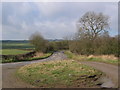
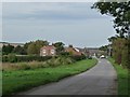
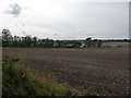
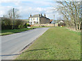
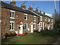
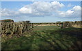
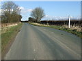
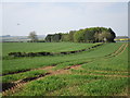
31 photos from this area
Area Information
Key information about the YO25 4RY including its size, population, and administrative classification.
- Area Type
- Postcode
- Area Size
- 29.2 hectares
- Population
- 1582
- Population Density
- 33 people/km²
House Prices in YO25 4RY
8
Properties
£273,333
Average Sold Price
£195,000
Lowest Price
£375,000
Highest Price
Showing 8 properties
| Address | Type | Beds | Baths | Last Sale Price | Last Sale Date | |
|---|---|---|---|---|---|---|
| Eastgate Cottage, Woldgate, Kilham, YO25 4RY | Semi-detached | - | - | £250,000 | Jul 2008 | |
| Fulbeck, Woldgate, Kilham, YO25 4RY | Detached | - | - | £375,000 | Mar 2005 | |
| Woldgate Cottage, Woldgate, Kilham, YO25 4RY | Detached | - | - | £195,000 | Apr 2000 | |
| Laurel Bank, Woldgate, Kilham, YO25 4RY | Detached | - | - | - | - | |
| Eastgate Lodge, Woldgate, Kilham, YO25 4RY | house | - | - | - | - | |
| Weir Cottage, Woldgate, Kilham, YO25 4RY | Detached | - | - | - | - | |
| Development House, Woldgate, Kilham, YO25 4RY | Semi-detached | - | - | - | - | |
| Woldview, Woldgate, Kilham, YO25 4RY | Detached | - | - | - | - |
Energy Efficiency in YO25 4RY
Amenities
Schools
| Rank | School | Type | Entry gender | Ages |
|---|
Explore more schools in this area
Go to Schools tabDemographics
Household Size
Two person
most common
Accommodation Type
Houses
most common
Tenure
76
majority
Ethnic Group
White
most common
Religion
N/A
most common
Household Composition
N/A
most common
Age
47
median
Adults (30-64 years)
most common
Household Deprivation
N/A
with no deprivation
NS-SEC
36
in Lower managerial occupations
Explore more demographic insights in this area
Go to Demographics tabPlanning
Planning Constraints
- Flood RiskPremium
- Ramsar Wetland SitesPremium
- Area of Outstanding Natural BeautyPremium
- Protected Nature ReservePremium
- Protected WoodlandPremium