Area Overview for YO25 4LJ
Photos of YO25 4LJ

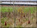
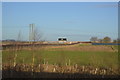
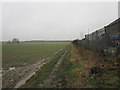
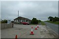
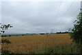
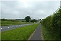
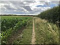
58 photos from this area
Area Information
Key information about the YO25 4LJ including its size, population, and administrative classification.
- Area Type
- Postcode
- Area Size
- 84.2 hectares
- Population
- 1840
- Population Density
- 51 people/km²
House Prices in YO25 4LJ
41
Properties
£230,407
Average Sold Price
£72,000
Lowest Price
£585,000
Highest Price
Showing 41 properties
| Address | Type | Beds | Baths | Last Sale Price | Last Sale Date | |
|---|---|---|---|---|---|---|
| Bantry House, 11 Westgate, Nafferton, YO25 4LJ | house | 5 | 3 | £365,000 | Jun 2025 | |
| Bay Tree Cottage, 17 Westgate, Nafferton, YO25 4LJ | house | - | - | £335,000 | Mar 2025 | |
| 41 Westgate, Nafferton, YO25 4LJ | Detached | 4 | 2 | £285,000 | Aug 2023 | |
| Marvic House, 55 Westgate, Nafferton, YO25 4LJ | Detached | 4 | 2 | £585,000 | Jan 2023 | |
| Kenwyn, 43 Westgate, Nafferton, YO25 4LJ | house | - | - | £195,000 | Sep 2022 | |
| Westholme, 27 Westgate, Nafferton, YO25 4LJ | house | - | - | £252,500 | Feb 2021 | |
| 8 Westgate, Nafferton, YO25 4LJ | house | - | - | £151,000 | Mar 2019 | |
| Westgate House, 37 Westgate, Nafferton, YO25 4LJ | Detached | 4 | 2 | £286,500 | Dec 2018 | |
| 14 Westgate, Nafferton, YO25 4LJ | Semi-detached | 4 | 2 | £172,500 | Dec 2017 | |
| Cherry Tree Cottage, 31 Westgate, Nafferton, YO25 4LJ | Semi-detached | 4 | 2 | £319,750 | May 2017 |
Page 1 of 5
Energy Efficiency in YO25 4LJ
Amenities
Schools
| Rank | School | Type | Entry gender | Ages |
|---|
Explore more schools in this area
Go to Schools tabDemographics
Household Size
Two person
most common
Accommodation Type
Houses
most common
Tenure
84
majority
Ethnic Group
White
most common
Religion
N/A
most common
Household Composition
N/A
most common
Age
47
median
Adults (30-64 years)
most common
Household Deprivation
N/A
with no deprivation
NS-SEC
37
in Lower managerial occupations
Explore more demographic insights in this area
Go to Demographics tabPlanning
Planning Constraints
- Flood RiskPremium
- Ramsar Wetland SitesPremium
- Area of Outstanding Natural BeautyPremium
- Protected Nature ReservePremium
- Protected WoodlandPremium