Area Overview for YO23 7DP
Photos of YO23 7DP
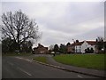
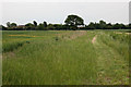
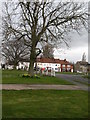
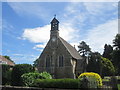
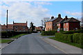
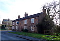
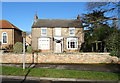
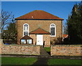
41 photos from this area
Area Information
Key information about the YO23 7DP including its size, population, and administrative classification.
- Area Type
- Postcode
- Area Size
- 22.9 hectares
- Population
- 1968
- Population Density
- 35 people/km²
House Prices in YO23 7DP
10
Properties
£512,500
Average Sold Price
£375,000
Lowest Price
£810,000
Highest Price
Showing 10 properties
| Address | Type | Beds | Baths | Last Sale Price | Last Sale Date | |
|---|---|---|---|---|---|---|
| Fieldview House, Chapel Green, Appleton Roebuck, YO23 7DP | house | - | - | £530,000 | Nov 2023 | |
| North Hall, Chapel Green, Appleton Roebuck, YO23 7DP | Detached | - | - | £500,000 | Jun 2022 | |
| Springbank, Chapel Green, Appleton Roebuck, YO23 7DP | Detached | 4 | 3 | £810,000 | Jun 2021 | |
| Yew Tree House, Chapel Green, Appleton Roebuck, YO23 7DP | house | - | - | £465,000 | Nov 2020 | |
| Mill Reef, Chapel Green, Appleton Roebuck, YO23 7DP | house | - | - | £395,000 | Jul 2007 | |
| Westfield House, Chapel Green, Appleton Roebuck, YO23 7DP | house | - | - | £375,000 | Dec 1999 | |
| Balquhidder, Main Street, Appleton Roebuck, YO23 7DP | Detached | - | - | - | - | |
| Garage Flat, Bridge Service Station, Chapel Green, Appleton Roebuck, YO23 7DP | Flat | - | - | - | - | |
| North Hall Farm, Chapel Green, Appleton Roebuck, YO23 7DP | Farm | - | - | - | - | |
| Flat Adjacent, Bridge View, Chapel Green, Appleton Roebuck, YO23 7DP | Flat | - | - | - | - |
Energy Efficiency in YO23 7DP
Amenities
Schools
| Rank | School | Type | Entry gender | Ages |
|---|
Explore more schools in this area
Go to Schools tabDemographics
Household Size
Family (3-5 people)
most common
Accommodation Type
Houses
most common
Tenure
80
majority
Ethnic Group
White
most common
Religion
N/A
most common
Household Composition
N/A
most common
Age
47
median
Adults (30-64 years)
most common
Household Deprivation
N/A
with no deprivation
NS-SEC
48
in Lower managerial occupations
Explore more demographic insights in this area
Go to Demographics tabPlanning
Planning Constraints
- Flood RiskPremium
- Ramsar Wetland SitesPremium
- Area of Outstanding Natural BeautyPremium
- Protected Nature ReservePremium
- Protected WoodlandPremium