Area Overview for YO23 7BP
Photos of YO23 7BP
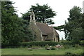
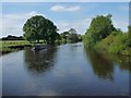
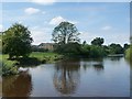
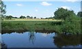
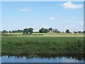
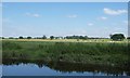
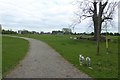
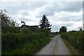
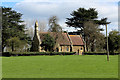
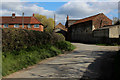
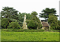
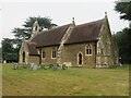
29 photos from this area
Area Information
Key information about the YO23 7BP including its size, population, and administrative classification.
- Area Type
- Postcode
- Area Size
- 5.8 km²
- Population
- 1968
- Population Density
- 35 people/km²
House Prices in YO23 7BP
22
Properties
£325,900
Average Sold Price
£125,000
Lowest Price
£640,000
Highest Price
Showing 22 properties
| Address | Type | Beds | Baths | Last Sale Price | Last Sale Date | |
|---|---|---|---|---|---|---|
| Ferry Farm Bungalow, Back Lane, Acaster Selby, YO23 7BP | Detached | 3 | - | £277,500 | Oct 2023 | |
| Draycotts, Back Lane, Acaster Selby, YO23 7BP | Detached | 4 | 2 | £640,000 | Aug 2023 | |
| River Cottage, Back Lane, Acaster Selby, YO23 7BP | Terraced | - | - | £275,000 | Jul 2006 | |
| Rosedene, Back Lane, Acaster Selby, YO23 7BP | Bungalow | - | - | £125,000 | Oct 2004 | |
| Windy Ridge, Back Lane, Acaster Selby, YO23 7BP | Detached | - | - | £312,000 | Aug 2003 | |
| Ousemouth Farm, Back Lane, Acaster Selby, YO23 7BP | Farm | - | - | - | - | |
| Cattery, Priory Farm, Back Lane, Acaster Selby, YO23 7BP | commercial | - | - | - | - | |
| Sailby, Back Lane, Acaster Selby, YO23 7BP | Detached | - | - | - | - | |
| Priory Farm, Back Lane, Acaster Selby, YO23 7BP | Farm | - | - | - | - | |
| River Farm, Back Lane, Acaster Selby, YO23 7BP | Farm | - | - | - | - |
Page 1 of 3
Energy Efficiency in YO23 7BP
Amenities
Schools
| Rank | School | Type | Entry gender | Ages |
|---|
Explore more schools in this area
Go to Schools tabDemographics
Household Size
Family (3-5 people)
most common
Accommodation Type
Houses
most common
Tenure
80
majority
Ethnic Group
White
most common
Religion
N/A
most common
Household Composition
N/A
most common
Age
47
median
Adults (30-64 years)
most common
Household Deprivation
N/A
with no deprivation
NS-SEC
48
in Lower managerial occupations
Explore more demographic insights in this area
Go to Demographics tabPlanning
Planning Constraints
- Flood RiskPremium
- Ramsar Wetland SitesPremium
- Area of Outstanding Natural BeautyPremium
- Protected Nature ReservePremium
- Protected WoodlandPremium