Area Overview for YO23 3PA
Photos of YO23 3PA
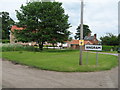
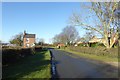
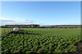
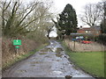
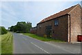
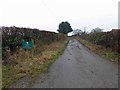
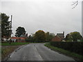
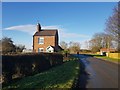
18 photos from this area
Area Information
Key information about the YO23 3PA including its size, population, and administrative classification.
- Area Type
- Postcode
- Area Size
- 5.1 km²
- Population
- 1431
- Population Density
- 29 people/km²
House Prices in YO23 3PA
27
Properties
£319,000
Average Sold Price
£182,000
Lowest Price
£400,000
Highest Price
Showing 27 properties
| Address | Type | Beds | Baths | Last Sale Price | Last Sale Date | |
|---|---|---|---|---|---|---|
| The Cottage, Dam Bridge To District Boundary, Angram, YO23 3PA | Detached | 4 | 2 | £400,000 | Dec 2005 | |
| Garbutt Cottage, Dam Bridge To District Boundary, Angram, YO23 3PA | Detached | - | - | £375,000 | Oct 2005 | |
| 3, Spence Croft, Dam Bridge To District Boundary, Angram, YO23 3PA | house | - | - | £182,000 | May 2005 | |
| Office 1, Sycamore Barn, Dam Bridge To District Boundary, Angram, YO23 3PA | office_workshop | - | - | - | - | |
| Stable Mews, Westgate House, Dam Bridge To District Boundary, Angram, YO23 3PA | Detached | - | - | - | - | |
| First Floor Office 2, Sycamore Barn, Dam Bridge To District Boundary, Angram, YO23 3PA | Office | - | - | - | - | |
| Ground Floor Office 2, Sycamore Barn, Dam Bridge To District Boundary, Angram, YO23 3PA | Office | - | - | - | - | |
| Chapel Hill, Chapel Hill Lane, Hutton Wandesley, YO23 3PA | Detached | 4 | 2 | - | - | |
| Keepers Cottage, Dam Bridge To Keepers Cottage, Angram, YO23 3PA | Detached | - | - | - | - | |
| Westgate House, Dam Bridge To District Boundary, Angram, YO23 3PA | Detached | - | - | - | - |
Page 1 of 3
Energy Efficiency in YO23 3PA
Amenities
Schools
| Rank | School | Type | Entry gender | Ages |
|---|
Explore more schools in this area
Go to Schools tabDemographics
Household Size
Two person
most common
Accommodation Type
Houses
most common
Tenure
75
majority
Ethnic Group
White
most common
Religion
N/A
most common
Household Composition
N/A
most common
Age
47
median
Adults (30-64 years)
most common
Household Deprivation
N/A
with no deprivation
NS-SEC
45
in Lower managerial occupations
Explore more demographic insights in this area
Go to Demographics tabPlanning
Planning Constraints
- Flood RiskPremium
- Ramsar Wetland SitesPremium
- Area of Outstanding Natural BeautyPremium
- Protected Nature ReservePremium
- Protected WoodlandPremium