Area Overview for YO22 5EX
Photos of YO22 5EX


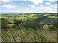
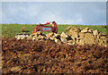
29 photos from this area
Area Information
Key information about the YO22 5EX including its size, population, and administrative classification.
- Area Type
- Postcode
- Area Size
- 35.6 hectares
- Population
- 1422
- Population Density
- 18 people/km²
House Prices in YO22 5EX
9
Properties
£356,125
Average Sold Price
£219,000
Lowest Price
£525,000
Highest Price
Showing 9 properties
| Address | Type | Beds | Baths | Last Sale Price | Last Sale Date | |
|---|---|---|---|---|---|---|
| Moorgate, Road From Moorgate Entrance To Blue Bank, Hobbin Head, Sleights, YO22 5EX | Bungalow | - | - | £400,000 | Dec 2024 | |
| Granary Cottage, Road From Moorgate Entrance To Blue Bank, Hobbin Head, Sleights, YO22 5EX | house | - | - | £280,500 | Sep 2020 | |
| Hobbin Ghyll, Road From Moorgate Entrance To Blue Bank, Hobbin Head, Sleights, YO22 5EX | house | 5 | 5 | £525,000 | Nov 2016 | |
| Hobbin Head, Road From Moorgate Entrance To Blue Bank, Hobbin Head, Sleights, YO22 5EX | house | 5 | 1 | £219,000 | Jan 2012 | |
| Spring Farm Cottage, Road From Moorgate Entrance To Blue Bank, Hobbin Head, Sleights, YO22 5EX | Detached | - | - | - | - | |
| Hobbin Ghyll, Little Beck Lane, Littlebeck, Whitby, YO22 5EX | Detached | - | - | - | - | |
| Pinewood Cottage, Road From Moorgate Entrance To Blue Bank, Hobbin Head, Sleights, YO22 5EX | undefined | - | - | - | - | |
| Brambly Cottage, Road From Moorgate Entrance To Blue Bank, Hobbin Head, Sleights, YO22 5EX | Detached | - | - | - | - | |
| Garth Cottage, Road From Moorgate Entrance To Blue Bank, Hobbin Head, Sleights, YO22 5EX | Semi-detached | - | - | - | - |
Energy Efficiency in YO22 5EX
Amenities
Schools
| Rank | School | Type | Entry gender | Ages |
|---|
Explore more schools in this area
Go to Schools tabDemographics
Household Size
Two person
most common
Accommodation Type
Houses
most common
Tenure
84
majority
Ethnic Group
White
most common
Religion
N/A
most common
Household Composition
N/A
most common
Age
47
median
Adults (30-64 years)
most common
Household Deprivation
N/A
with no deprivation
NS-SEC
36
in Lower managerial occupations
Explore more demographic insights in this area
Go to Demographics tabPlanning
Planning Constraints
- Flood RiskPremium
- Ramsar Wetland SitesPremium
- Area of Outstanding Natural BeautyPremium
- Protected Nature ReservePremium
- Protected WoodlandPremium