Area Overview for YO22 4NT
Photos of YO22 4NT
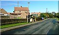

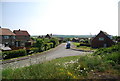

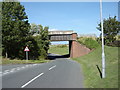
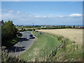
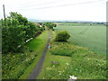
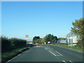
54 photos from this area
Area Information
Key information about the YO22 4NT including its size, population, and administrative classification.
- Area Type
- Postcode
- Area Size
- 29.0 hectares
- Population
- 1947
- Population Density
- 29 people/km²
House Prices in YO22 4NT
34
Properties
£193,636
Average Sold Price
£69,950
Lowest Price
£365,000
Highest Price
Showing 34 properties
| Address | Type | Beds | Baths | Last Sale Price | Last Sale Date | |
|---|---|---|---|---|---|---|
| Rambler Cottage, Stainsacre Lane, Whitby, YO22 4NT | house | - | - | £225,000 | Apr 2025 | |
| Laurel Cottage, Stainsacre Lane, Whitby, YO22 4NT | house | - | - | £168,000 | Feb 2022 | |
| Horton, Stainsacre Lane, Stainsacre, Whitby, YO22 4NT | Semi-detached | 3 | 2 | £262,000 | Jun 2021 | |
| Browside, Stainsacre Lane, Stainsacre, Whitby, YO22 4NT | Semi-detached | 3 | 1 | £144,000 | Feb 2019 | |
| Woodbine Cottage, Stainsacre Lane, Whitby, YO22 4NT | house | - | - | £156,000 | Apr 2018 | |
| Windyridge, Stainsacre Lane, Stainsacre, Whitby, YO22 4NT | house | - | - | £213,000 | May 2017 | |
| The Farm, Summerfield Lane, Stainsacre, Whitby, YO22 4NT | house | - | - | £225,000 | Aug 2014 | |
| Hall Farm, Stainsacre Lane, Stainsacre, Whitby, YO22 4NT | house | 6 | - | £365,000 | Nov 2009 | |
| Lion Cottage, Stainsacre Lane, Whitby, YO22 4NT | Terraced | - | - | £195,000 | Feb 2008 | |
| Ivy Cottage, Stainsacre Lane, Stainsacre, Whitby, YO22 4NT | house | 2 | - | £169,950 | Aug 2007 |
Page 1 of 4
Energy Efficiency in YO22 4NT
Amenities
Schools
| Rank | School | Type | Entry gender | Ages |
|---|
Explore more schools in this area
Go to Schools tabDemographics
Household Size
Two person
most common
Accommodation Type
Houses
most common
Tenure
78
majority
Ethnic Group
White
most common
Religion
N/A
most common
Household Composition
N/A
most common
Age
47
median
Adults (30-64 years)
most common
Household Deprivation
N/A
with no deprivation
NS-SEC
31
in Lower managerial occupations
Explore more demographic insights in this area
Go to Demographics tabPlanning
Planning Constraints
- Flood RiskPremium
- Ramsar Wetland SitesPremium
- Area of Outstanding Natural BeautyPremium
- Protected Nature ReservePremium
- Protected WoodlandPremium