Area Overview for YO21 3TG
Photos of YO21 3TG
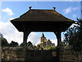
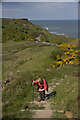

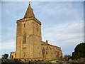
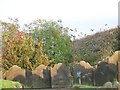
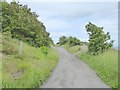
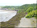
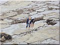
100 photos from this area
Area Information
Key information about the YO21 3TG including its size, population, and administrative classification.
- Area Type
- Postcode
- Area Size
- 22.9 hectares
- Population
- 1285
- Population Density
- 21 people/km²
House Prices in YO21 3TG
18
Properties
£723,333
Average Sold Price
£235,000
Lowest Price
£1,385,000
Highest Price
Showing 18 properties
| Address | Type | Beds | Baths | Last Sale Price | Last Sale Date | |
|---|---|---|---|---|---|---|
| Sandygate House, Lythe Bank, Sandsend, Whitby, YO21 3TG | house | - | - | £1,385,000 | Feb 2023 | |
| Summerfield, Lythe Bank, Sandsend, Whitby, YO21 3TG | Detached | - | - | £550,000 | Jun 2006 | |
| Sunnyside Cottage, Lythe Bank, Sandsend, Whitby, YO21 3TG | house | - | - | £235,000 | Nov 2002 | |
| The Haven, Lythe Bank, Sandsend, Whitby, YO21 3TG | undefined | - | - | - | - | |
| Tea Shop, Lythe Bank, Sandsend, Whitby, YO21 3TG | undefined | - | - | - | - | |
| Alderside, Lythe Bank, Sandsend, Whitby, YO21 3TG | undefined | - | - | - | - | |
| Rose Cottage, Lythe Bank, Sandsend, Whitby, YO21 3TG | house | - | - | - | - | |
| Sunny Corner, Lythe Bank, Sandsend, Whitby, YO21 3TG | Terraced | - | - | - | - | |
| Station House, Lythe Bank, Sandsend, Whitby, YO21 3TG | Flat | - | - | - | - | |
| 2, Sunnyside Cottage, Lythe Bank, Sandsend, Whitby, YO21 3TG | undefined | - | - | - | - |
Page 1 of 2
Energy Efficiency in YO21 3TG
Amenities
Schools
| Rank | School | Type | Entry gender | Ages |
|---|
Explore more schools in this area
Go to Schools tabDemographics
Household Size
Two person
most common
Accommodation Type
Houses
most common
Tenure
63
majority
Ethnic Group
White
most common
Religion
N/A
most common
Household Composition
N/A
most common
Age
47
median
Adults (30-64 years)
most common
Household Deprivation
N/A
with no deprivation
NS-SEC
32
in Lower managerial occupations
Explore more demographic insights in this area
Go to Demographics tabPlanning
Planning Constraints
- Flood RiskPremium
- Ramsar Wetland SitesPremium
- Area of Outstanding Natural BeautyPremium
- Protected Nature ReservePremium
- Protected WoodlandPremium