Area Overview for YO19 5PF
Photos of YO19 5PF


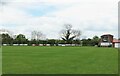
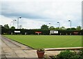
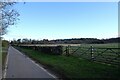
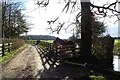


36 photos from this area
Area Information
Key information about the YO19 5PF including its size, population, and administrative classification.
- Area Type
- Postcode
- Area Size
- 1.3 hectares
- Population
- 1924
- Population Density
- 64 people/km²
House Prices in YO19 5PF
15
Properties
£227,657
Average Sold Price
£101,500
Lowest Price
£379,500
Highest Price
Showing 15 properties
| Address | Type | Beds | Baths | Last Sale Price | Last Sale Date | |
|---|---|---|---|---|---|---|
| 15 Greenside Close, Dunnington, York, YO19 5PF | Bungalow | - | - | £379,500 | Oct 2021 | |
| 6 Greenside Close, Dunnington, York, YO19 5PF | Bungalow | - | - | £290,000 | Dec 2017 | |
| 8 Greenside Close, Dunnington, York, YO19 5PF | Bungalow | - | - | £247,500 | Feb 2017 | |
| 11 Greenside Close, Dunnington, York, YO19 5PF | Bungalow | 3 | - | £250,000 | Aug 2013 | |
| 2 Greenside Close, Dunnington, York, YO19 5PF | Bungalow | - | - | £180,000 | Apr 2010 | |
| 13 Greenside Close, Dunnington, York, YO19 5PF | Detached | - | - | £249,950 | Dec 2006 | |
| 12 Greenside Close, Dunnington, York, YO19 5PF | Detached | - | - | £259,370 | Jun 2005 | |
| 14 Greenside Close, Dunnington, York, YO19 5PF | Detached | - | - | £158,750 | Jan 2003 | |
| 1 Greenside Close, Dunnington, York, YO19 5PF | Detached | 4 | 2 | £160,000 | May 2002 | |
| 10 Greenside Close, Dunnington, York, YO19 5PF | Bungalow | - | - | £101,500 | May 1999 |
Page 1 of 2
Energy Efficiency in YO19 5PF
Amenities
Schools
| Rank | School | Type | Entry gender | Ages |
|---|
Explore more schools in this area
Go to Schools tabDemographics
Household Size
Two person
most common
Accommodation Type
Houses
most common
Tenure
88
majority
Ethnic Group
White
most common
Religion
N/A
most common
Household Composition
N/A
most common
Age
47
median
Adults (30-64 years)
most common
Household Deprivation
N/A
with no deprivation
NS-SEC
44
in Lower managerial occupations
Explore more demographic insights in this area
Go to Demographics tabPlanning
Planning Constraints
- Flood RiskPremium
- Ramsar Wetland SitesPremium
- Area of Outstanding Natural BeautyPremium
- Protected Nature ReservePremium
- Protected WoodlandPremium