Area Overview for YO19 5NS
Photos of YO19 5NS


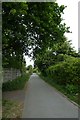
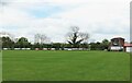
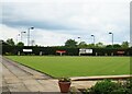
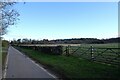


36 photos from this area
Area Information
Key information about the YO19 5NS including its size, population, and administrative classification.
- Area Type
- Postcode
- Area Size
- 7576 m²
- Population
- 1735
- Population Density
- 1539 people/km²
House Prices in YO19 5NS
15
Properties
£427,800
Average Sold Price
£204,000
Lowest Price
£650,000
Highest Price
Showing 15 properties
| Address | Type | Beds | Baths | Last Sale Price | Last Sale Date | |
|---|---|---|---|---|---|---|
| Naunton, 34 Water Lane, Dunnington, York, YO19 5NS | Detached | 4 | 1 | £450,000 | Jul 2025 | |
| 36 Water Lane, Dunnington, York, YO19 5NS | Semi-detached | 4 | 2 | £538,000 | Dec 2023 | |
| 18 Water Lane, Dunnington, York, YO19 5NS | Semi-detached | 3 | 1 | £320,000 | Sep 2022 | |
| Stoney Lea, 32 Water Lane, Dunnington, York, YO19 5NS | house | 4 | 1 | £440,000 | Sep 2022 | |
| 30 Water Lane, Dunnington, York, YO19 5NS | house | - | - | £396,000 | Sep 2021 | |
| Applegarth, 26 Water Lane, Dunnington, York, YO19 5NS | house | - | - | £650,000 | Jun 2021 | |
| Little Orchard, 22 Water Lane, Dunnington, York, YO19 5NS | Detached | 4 | 2 | £650,000 | Feb 2021 | |
| 38 Water Lane, Dunnington, York, YO19 5NS | house | - | - | £300,000 | Feb 2019 | |
| Roseville, 24 Water Lane, Dunnington, York, YO19 5NS | house | - | - | £330,000 | Jul 2014 | |
| Melford House, 28 Water Lane, Dunnington, York, YO19 5NS | Semi-detached | - | - | £204,000 | Oct 2002 |
Page 1 of 2
Energy Efficiency in YO19 5NS
Amenities
Schools
| Rank | School | Type | Entry gender | Ages |
|---|
Explore more schools in this area
Go to Schools tabDemographics
Household Size
Two person
most common
Accommodation Type
Houses
most common
Tenure
80
majority
Ethnic Group
White
most common
Religion
N/A
most common
Household Composition
N/A
most common
Age
47
median
Adults (30-64 years)
most common
Household Deprivation
N/A
with no deprivation
NS-SEC
45
in Lower managerial occupations
Explore more demographic insights in this area
Go to Demographics tabPlanning
Planning Constraints
- Flood RiskPremium
- Ramsar Wetland SitesPremium
- Area of Outstanding Natural BeautyPremium
- Protected Nature ReservePremium
- Protected WoodlandPremium