Area Overview for YO18 8RQ
Photos of YO18 8RQ
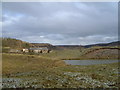
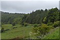
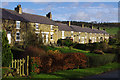
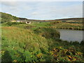
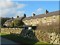
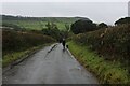
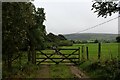
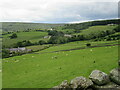
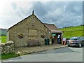
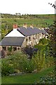
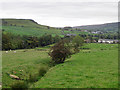
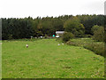
37 photos from this area
Area Information
Key information about the YO18 8RQ including its size, population, and administrative classification.
- Area Type
- Postcode
- Area Size
- 13.8 hectares
- Population
- 1307
- Population Density
- 7 people/km²
House Prices in YO18 8RQ
17
Properties
£175,200
Average Sold Price
£56,900
Lowest Price
£265,000
Highest Price
Showing 17 properties
| Address | Type | Beds | Baths | Last Sale Price | Last Sale Date | |
|---|---|---|---|---|---|---|
| 9A, School Row, Alders Road, Rosedale East, YO18 8RQ | Cottage | 2 | 1 | £253,000 | Dec 2025 | |
| 7, School Row, Alders Road, Rosedale East, YO18 8RQ | house | - | - | £230,000 | Aug 2024 | |
| 5, School Row, Alders Road, Rosedale East, YO18 8RQ | Terraced | 3 | 1 | £265,000 | Feb 2023 | |
| 8, School Row, Alders Road, Rosedale East, YO18 8RQ | house | - | - | £169,500 | Oct 2011 | |
| 14, School Row, Alders Road, Rosedale East, YO18 8RQ | house | - | - | £180,000 | Jun 2010 | |
| 10, School Row, Alders Road, Rosedale East, YO18 8RQ | Terraced | - | - | £72,000 | Aug 2000 | |
| 15, School Row, Alders Road, Rosedale East, YO18 8RQ | Terraced | - | - | £56,900 | May 1996 | |
| 3, School Row, Alders Road, Rosedale East, YO18 8RQ | Terraced | - | - | - | - | |
| 1, School Row, Alders Road, Rosedale East, YO18 8RQ | Terraced | - | - | - | - | |
| 11, School Row, Alders Road, Rosedale East, YO18 8RQ | Terraced | - | - | - | - |
Page 1 of 2
Energy Efficiency in YO18 8RQ
Amenities
Schools
| Rank | School | Type | Entry gender | Ages |
|---|
Explore more schools in this area
Go to Schools tabDemographics
Household Size
Two person
most common
Accommodation Type
Houses
most common
Tenure
72
majority
Ethnic Group
White
most common
Religion
N/A
most common
Household Composition
N/A
most common
Age
47
median
Adults (30-64 years)
most common
Household Deprivation
N/A
with no deprivation
NS-SEC
38
in Lower managerial occupations
Explore more demographic insights in this area
Go to Demographics tabPlanning
Planning Constraints
- Flood RiskPremium
- Ramsar Wetland SitesPremium
- Area of Outstanding Natural BeautyPremium
- Protected Nature ReservePremium
- Protected WoodlandPremium