Area Overview for YO18 8QA
Photos of YO18 8QA
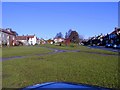


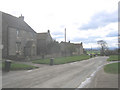
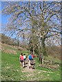
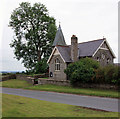
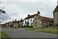
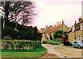

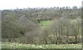
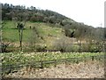
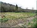
100 photos from this area
Area Information
Key information about the YO18 8QA including its size, population, and administrative classification.
- Area Type
- Postcode
- Area Size
- 71.0 hectares
- Population
- 1533
- Population Density
- 18 people/km²
House Prices in YO18 8QA
58
Properties
£325,463
Average Sold Price
£33,500
Lowest Price
£1,075,000
Highest Price
Showing 58 properties
| Address | Type | Beds | Baths | Last Sale Price | Last Sale Date | |
|---|---|---|---|---|---|---|
| Anvil Cottage, High Street, Newton On Rawcliffe, YO18 8QA | house | - | - | £440,000 | Jan 2025 | |
| Old Pond House, High Street, Newton On Rawcliffe, YO18 8QA | house | 2 | - | £490,000 | Jan 2025 | |
| Pond Farm, High Street, Newton On Rawcliffe, YO18 8QA | Detached | 5 | 4 | £1,050,000 | Oct 2024 | |
| Swan Cottage, High Street, Newton On Rawcliffe, YO18 8QA | Cottage | 4 | 3 | £335,000 | May 2023 | |
| Mel House, High Street, Newton On Rawcliffe, YO18 8QA | Detached | 16 | 8 | £1,075,000 | May 2022 | |
| Edistan Cottage, High Street, Newton On Rawcliffe, YO18 8QA | house | - | - | £520,000 | Jun 2021 | |
| North Cottage, High Street, Newton On Rawcliffe, YO18 8QA | house | - | - | £476,500 | Jun 2021 | |
| School House, High Street, Newton On Rawcliffe, YO18 8QA | house | - | - | £340,000 | Jan 2020 | |
| Spring Cottage, High Street, Newton On Rawcliffe, YO18 8QA | Terraced | 2 | 1 | £166,500 | Jun 2018 | |
| Holly House, High Street, Newton On Rawcliffe, YO18 8QA | Detached | 4 | 2 | £545,000 | Jun 2018 |
Page 1 of 6
Energy Efficiency in YO18 8QA
Amenities
Schools
| Rank | School | Type | Entry gender | Ages |
|---|
Explore more schools in this area
Go to Schools tabDemographics
Household Size
Two person
most common
Accommodation Type
Houses
most common
Tenure
82
majority
Ethnic Group
White
most common
Religion
N/A
most common
Household Composition
N/A
most common
Age
47
median
Adults (30-64 years)
most common
Household Deprivation
N/A
with no deprivation
NS-SEC
36
in Lower managerial occupations
Explore more demographic insights in this area
Go to Demographics tabPlanning
Planning Constraints
- Flood RiskPremium
- Ramsar Wetland SitesPremium
- Area of Outstanding Natural BeautyPremium
- Protected Nature ReservePremium
- Protected WoodlandPremium