Area Overview for YO18 7DB
Photos of YO18 7DB

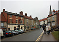
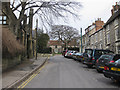
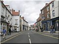
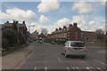

100 photos from this area
Area Information
Key information about the YO18 7DB including its size, population, and administrative classification.
- Area Type
- Postcode
- Area Size
- 2.9 hectares
- Population
- 2227
- Population Density
- 481 people/km²
House Prices in YO18 7DB
6
Properties
£251,488
Average Sold Price
£123,000
Lowest Price
£418,000
Highest Price
Showing 6 properties
| Address | Type | Beds | Baths | Last Sale Price | Last Sale Date | |
|---|---|---|---|---|---|---|
| Wheel Gates, 15 Mill Lane, Pickering, YO18 7DB | Bungalow | - | - | £418,000 | Jun 2021 | |
| 2A Mill Lane, Pickering, YO18 7DB | Bungalow | 2 | 1 | £299,950 | Apr 2021 | |
| Spring Cottage, 2 Mill Lane, Pickering, YO18 7DB | house | - | - | £123,000 | Jun 2015 | |
| Beck Cottage, Mill Lane, Pickering, YO18 7DB | Semi-detached | - | - | £165,000 | Jul 2001 | |
| Riparian Lodge, Mill Lane, Pickering, YO18 7DB | Detached | - | - | - | - | |
| 1, Railway Cottages, Mill Lane, Pickering, YO18 7DB | Detached | - | - | - | - |
Energy Efficiency in YO18 7DB
Amenities
Schools
| Rank | School | Type | Entry gender | Ages |
|---|
Explore more schools in this area
Go to Schools tabDemographics
Household Size
Two person
most common
Accommodation Type
Houses
most common
Tenure
75
majority
Ethnic Group
White
most common
Religion
N/A
most common
Household Composition
N/A
most common
Age
47
median
Elderly (65+ years)
most common
Household Deprivation
N/A
with no deprivation
NS-SEC
36
in Lower managerial occupations
Explore more demographic insights in this area
Go to Demographics tabPlanning
Planning Constraints
- Flood RiskPremium
- Ramsar Wetland SitesPremium
- Area of Outstanding Natural BeautyPremium
- Protected Nature ReservePremium
- Protected WoodlandPremium