Area Overview for YO17 8QF
Photos of YO17 8QF


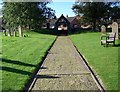


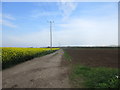
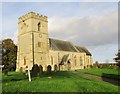
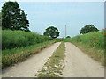
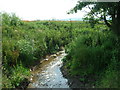
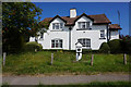


14 photos from this area
Area Information
Key information about the YO17 8QF including its size, population, and administrative classification.
- Area Type
- Postcode
- Area Size
- 45.0 hectares
- Population
- 2034
- Population Density
- 29 people/km²
House Prices in YO17 8QF
13
Properties
£248,681
Average Sold Price
£59,950
Lowest Price
£500,000
Highest Price
Showing 13 properties
| Address | Type | Beds | Baths | Last Sale Price | Last Sale Date | |
|---|---|---|---|---|---|---|
| Lyncroft, Mill Field, Sherburn, YO17 8QF | Semi-detached | - | - | £170,000 | Jan 2025 | |
| 4, Millfield Cottages, Mill Field, Sherburn, YO17 8QF | Terraced | 3 | 2 | £220,000 | Nov 2024 | |
| Lavender Cottage, Mill Field, Sherburn, YO17 8QF | Semi-detached | 2 | 1 | £262,500 | Oct 2024 | |
| Moor View, Mill Field, Sherburn, YO17 8QF | house | - | - | £275,000 | Jul 2022 | |
| Millfield House, Mill Field, Sherburn, YO17 8QF | Detached | 5 | 3 | £500,000 | Aug 2020 | |
| 1, Millfield Cottages, Mill Field, Sherburn, YO17 8QF | Terraced | 3 | - | £157,000 | Jul 2020 | |
| Mill House, Mill Field, Sherburn, YO17 8QF | house | - | - | £345,000 | Oct 2007 | |
| 3, Millfield Cottages, Mill Field, Sherburn, YO17 8QF | Terraced | 3 | 1 | £59,950 | Nov 2002 | |
| Housemartins At Millfield House, Mill Field, Sherburn, YO17 8QF | Flat | - | - | - | - | |
| 1, Mill Villas, Mill Field, Sherburn, YO17 8QF | house | - | - | - | - |
Page 1 of 2
Energy Efficiency in YO17 8QF
Amenities
Schools
| Rank | School | Type | Entry gender | Ages |
|---|
Explore more schools in this area
Go to Schools tabDemographics
Household Size
Two person
most common
Accommodation Type
Houses
most common
Tenure
63
majority
Ethnic Group
White
most common
Religion
N/A
most common
Household Composition
N/A
most common
Age
47
median
Adults (30-64 years)
most common
Household Deprivation
N/A
with no deprivation
NS-SEC
24
in Lower managerial occupations
Explore more demographic insights in this area
Go to Demographics tabPlanning
Planning Constraints
- Flood RiskPremium
- Ramsar Wetland SitesPremium
- Area of Outstanding Natural BeautyPremium
- Protected Nature ReservePremium
- Protected WoodlandPremium